I’m in the City of London and trying to avoid using manual if possible. But some streets are really testing my patience!
Any tips for this one? It’s a street running through the middle of a middle but because the entrance on the south side goes outside briefly it messes up the angle so I haven’t hit these nodes over around a half dozen attempts.
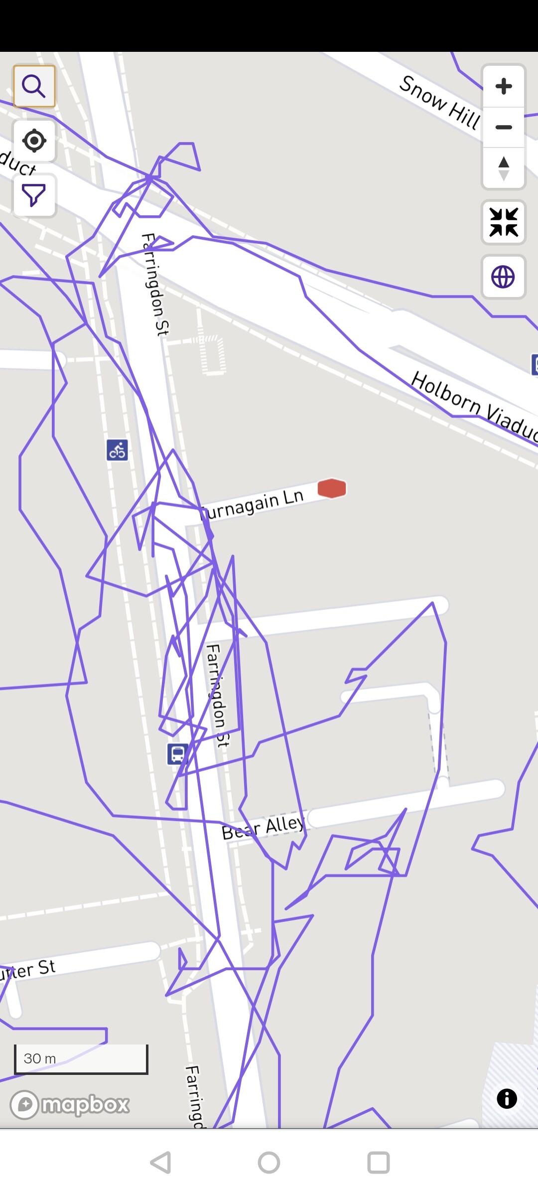
And if you have tips for that one, how about this? It’s an alley surrounded by very tall buildings which I’ve been down a few times but as you can see: no luck with the GPS.
(As I say I’d like to avoid manual if possible: if only to compensate for the fact that I know I’ve earnt the odd street I don’t deserve cos the GPS goes crazy in this city due to all the tall buildings with very narrow alleys)
What you could do is edit the source GPX file (or a different format, that depends on the tools you are using). If it is a small edit you can do that in any text editor (but you will have to know the coordinates), otherwise there are tools that can convert a planned route to a GPX file. As long you have really been there and don’t give yourself crazy fast times
+1. if your gpx is not reflecting your real life achievment, imho you can adjust to show what you rwally did. It’s up to anybody to use this for his or own benefit/cheat/whatever someone wants to do
Thanks for sharing the screenshots. I’ve been thinking about some kind of “snap to road” thing or rethinking how progress is determined - right now it’s comparing your GPS coordinates with Nodes 1:1, but sometimes it might be more accurate to look at the path itself and determine which Nodes are along that path.
After seeing the screenshots (especially the second one), it’s helped me realize that those ideas wouldn’t help in many situations. If the traced GPS path is so off, no amount of snapping or looking at the overall path is going to help.
Strava used to have that feature, but they dropped it. It was probably too costly…
When I was still running with my phone, there were many situations where ‘snapping’ still wouldn’t accurately reflect my run.
There use to be one called ‘Raceshape Snap’ that I used a couple times to correct some really wonky GPS due to tall buildings in San Francisco. Worked well IMO. One day it was just no longer available. According to the interwebs (here), creator was hired by Strava and then project was killed. Be careful out there @JamesChevalier! They may hear you!
Mapbox has a Map Matching API (demo) that works decently well, but still has some really weird output if I draw particularly odd lines (though some of this could be down to it defaulting to driving vs walking & respecting one way streets etc).
There’d need to be some kind of interactive UI where “teh codez” snaps the path to streets as best it can, and then allows you to make corrections. As long as the initial snap was decently accurate, and the correction process wasn’t mind-bogglingly tedious it might work out ok… I’m going to add this to #ideas to see how much interest there is: Ability to clean/correct/snap activity paths?


 I’m going to add this to