James suggested start a new thread spawned off The Trouble with Trunk Roads as below ones are not “trunk” roads.
Another bunch that are probably worse than near motorway type “trunk” roads are
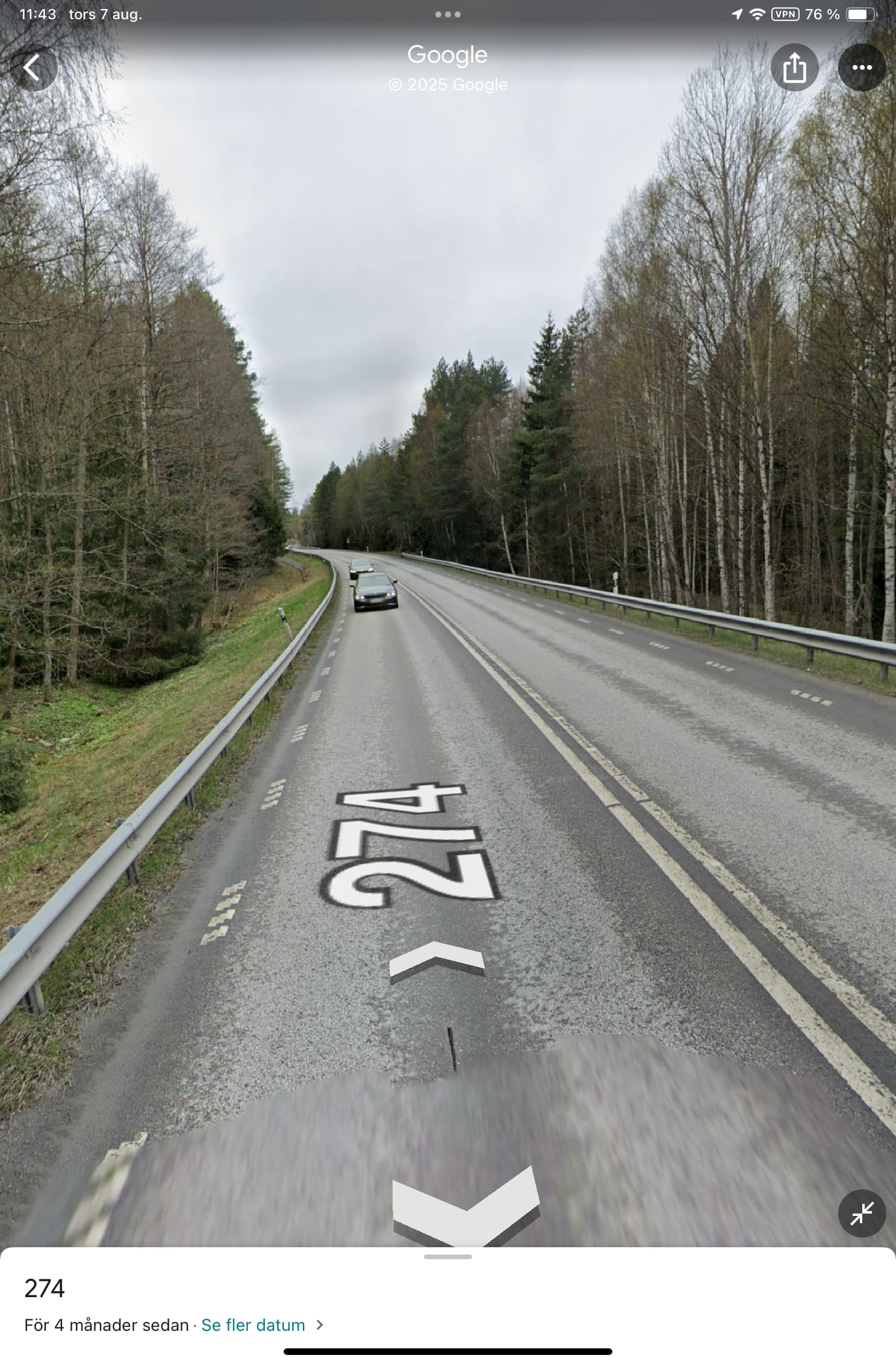
Saint Peter’s Way - CityStrides - 50 mph dual carriageway towards the M25 motorway
Addlestone Interchange - CityStrides - big “interchange” roundabout with the dual carriageways with slip roads to the M25
St Peter’s Way - CityStrides - 50 mph dual carriageway towards the M25 motorway from other direction
You can only get to the interchange/roundabout by any road means from either the M25 itself or those approach dual carriageways. So on foot only from the dual carriageways.
All I see are only a “Primary Road” not a “Trunk” road and in OSM primary roads get access=yes for everybody by default without need for any explicit tagging.
I see Jimmy (3rd globally) has ran the roundabout and the easterly dual carriageway. I am “leading” this city and at now 83% have been wondering how/if I address these as will “need” to soon. Again they are just roads pedestrians would be ill advised to tackle. I rarely if ever recall seeing a cyclist on them either although that would not be too bad I think. That said the dual carriageways do have a “mini” hard shoulder and several laybys but even so not at all “pleasant” and based on your Bentley Bypass comments am sure the advice is DO NOT. In fact at the moment the approach dual carriageways are having some work done on them to somehow “upgrade” them which at least in part means one lane is blocked off for vehicles although I don’t the idea is that runners are meant to use the blocked either - general idea is that lane is being rebuilt and you might fall down a hole!
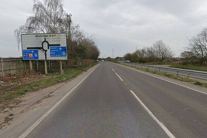
Here is a view from the westerly dual carriageway approaching the interchange. Not at all safe and a pedestrian would have to cross over a free flowing slip road to the M25 motorway.
![]() Street View of Addlestone · Google Maps
Street View of Addlestone · Google Maps
Street View of Addlestone · Google Maps
United Kingdom
In the UK AFAIK only motorways like the M25 or other roads with no explicit no pedestrians signs signs prohibit pedestrians by law. These roads (or Bentley Bypass) I would argue do not fall under that and are “technically” accessible on foot even if are clearly not intended that you do. And yet there are here on CS. Maybe in such cases you just need some sort of “manual” override over OSM tagging. I think it is one where foot=discouraged is effectively true but note the comments at Key:access - OpenStreetMap Wiki which rather “discourages” its actual use and I have never.
Looking further parts of the interchange have been explicitly tagged as foot=yes
Note this changeset Way: Addlestone Interchange (19825512) | OpenStreetMap where it foot=yes was applied with comment “Add whether roads are prohibited for pedestrians”. So their logic here is binary - if it is not prohibited then it must be yes which is sort of true. Legally I do not believe it is access=no and certainly not private, destination, permissive
Trouble is where is the boundary here. I have ran loads of streets with no sidewalks and indeed where I safely can now I prefer to run in the road as it is just easier as I don’t interfere with much slower walkers, our sidewalks/pavements are often trip hazards or “at best” uneven and feel am more “visible” to motorists to the side especially if run on the side “facing” oncoming traffic as then I can always nip to the side if that seems “better”.
Of further note at present both dual carriageways have mostly been reduced to one operational lane due to a seeming construction project to “improve” the road which suggests making it even more pedestrian unfriendly. That said I did wonder if I could use the sectioned off lane but I think the general idea is that lane is being dug up!