I’ve tried to find a relevant thread to put this. Hope it’s ok to start a new.
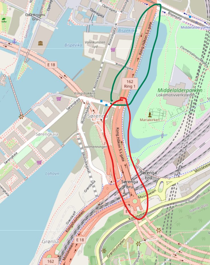
A couple if weeks ago there was a massive update in the road network. Some highly trafficked roads where there should be no pedestrians used to be excluded from the network, but now many dangerous roads have been included. Some of them are marked “Trunk” in OSM. One road, “Haakon V’s gate” in Oslo, starts as street with pavements, but transits into a brigde that leads into the motorway systems that of course does not allow pedestrians. Maybe this is the problem?
It looks like there are 38 streets (528 individual way records) in Oslo that are tagged as highway=trunk and also not tagged as expressway=yes or motorroad=yes or foot=no … Some of them, like Way: Østre Aker vei (1425644282) | OpenStreetMap definitely do not seem fit for pedestrians (by finding it in Google Street View and being certain that nobody should be running there).