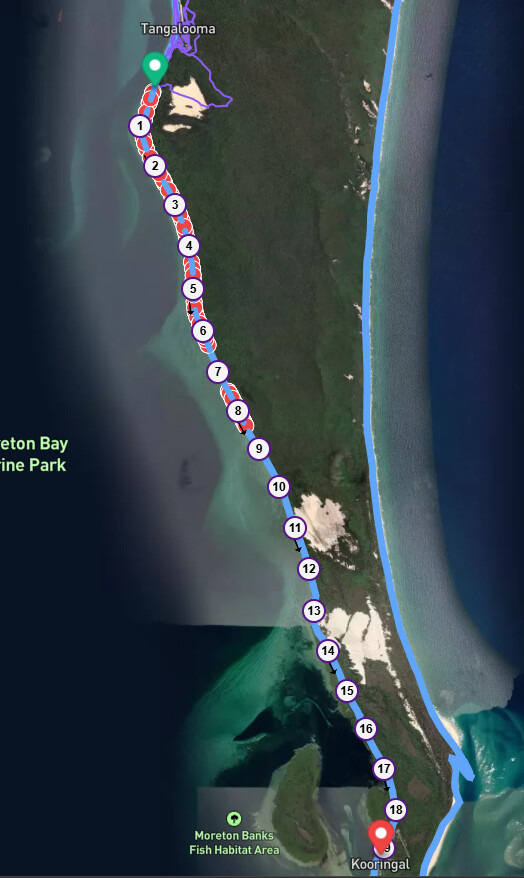
A bunch of us in Brisbane are chipping away at the 14,000 streets to complete, in fact @guy_sonia has almost finished. However, none of us are looking forward to heading over to Moreton Island (only accessible by ferry) to run on the 4WD loose sand streets, which includes running along the beach for 20km for one “street”, and other long cross island 4WD roads.
I had a short holiday over there recently and only did a small part around my accommodation, and I believe that running these sorts of roads is not what CityStrides is about, as they are not really runable, and unsafe if a vehicle comes along. However, they are tagged as tracks, so what can you do?
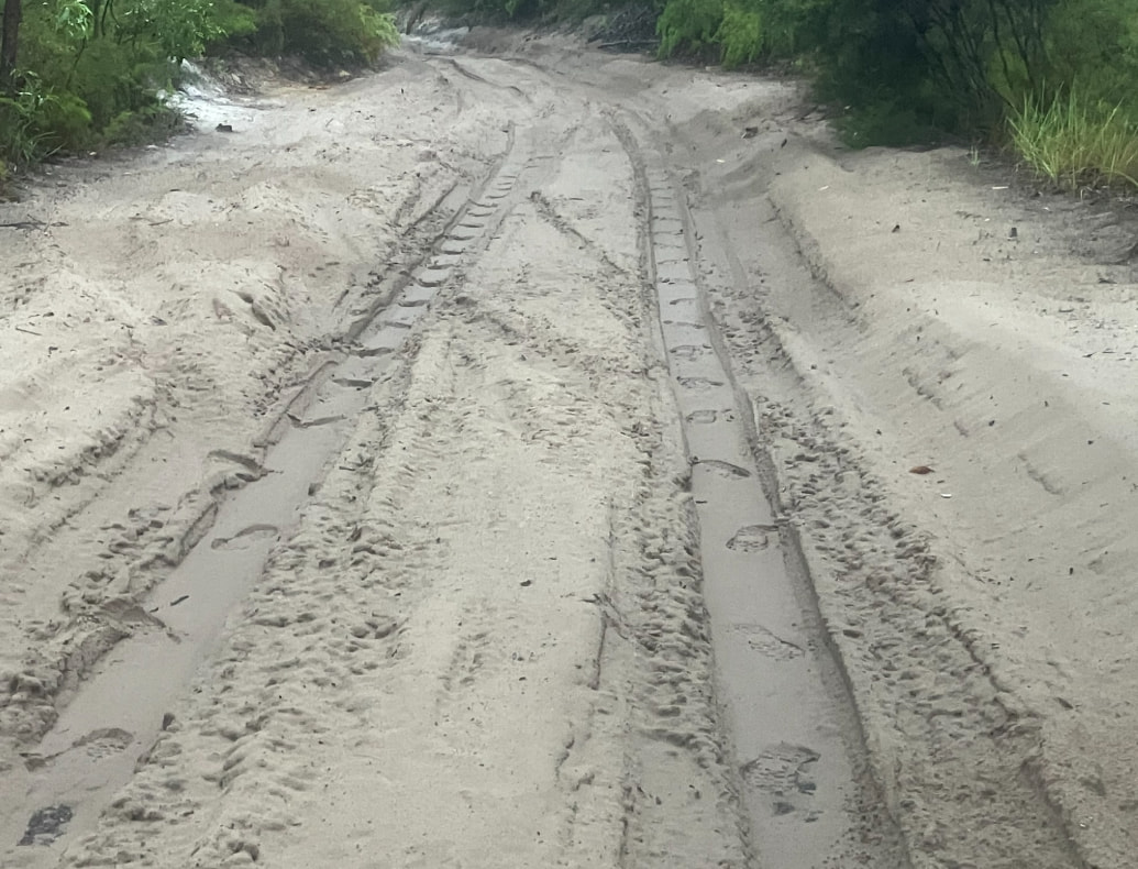
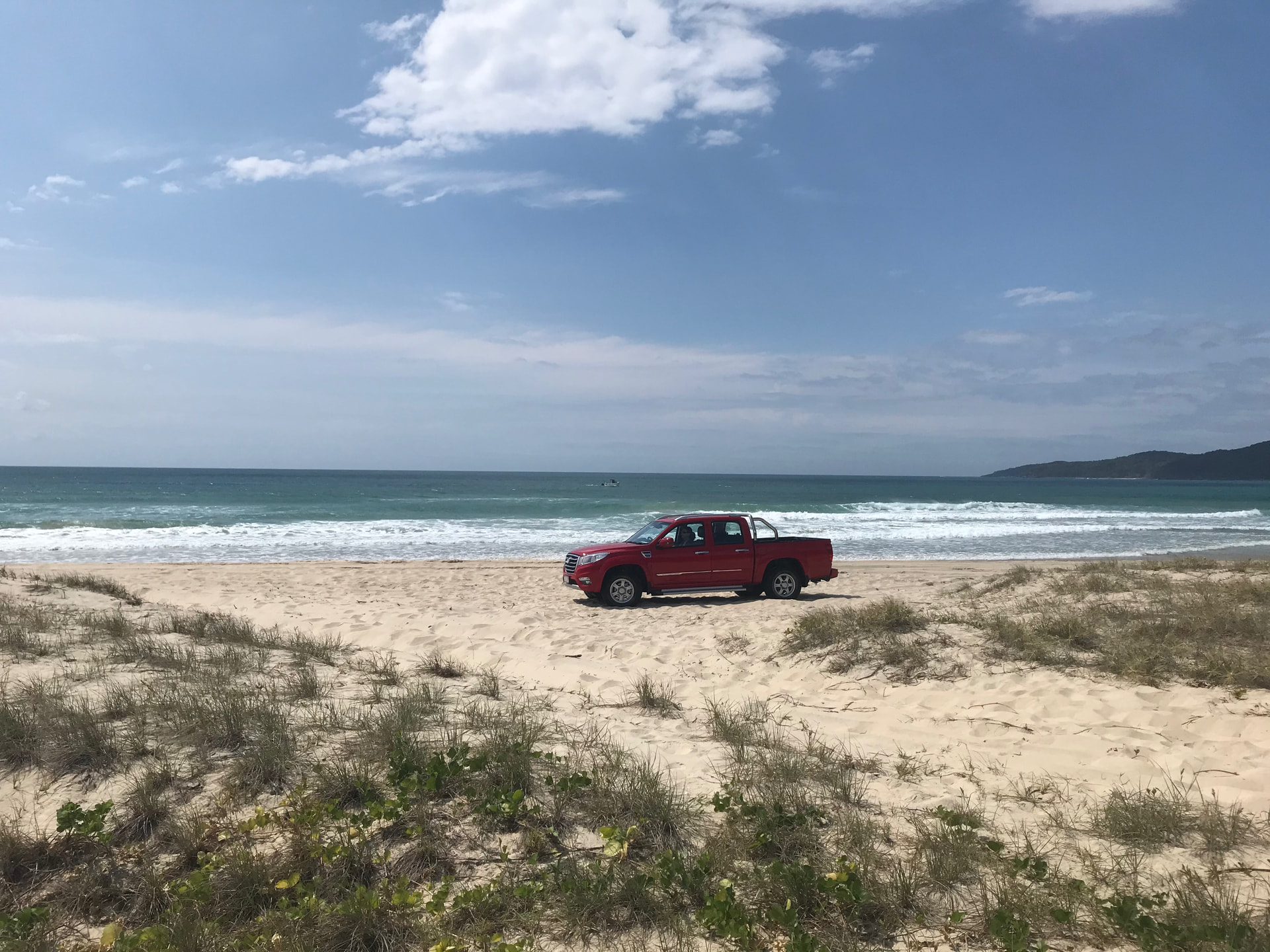
These are my footprints heading one way and back, because noone else is silly enough to run there.
What are people’s thoughts on this? I know there have been conversations about including tracks before, and I’m okay with tracks being included in general, but this seems a bit extreme.
It looks like there is a key for 4WD only that could possibly be used or sand as the surface type, but that might get rid of some of the bush tracks as well, which are okay to run.
Here in the US I have run into quite a few tracks that appear in CityStrides. Here they are typically paths through forest areas, so I typically go ahead and run them even though they are truly not streets. In some cases after running them I edit OSM and change them to footpaths as they don’t meet the criteria for being considered tracks. In your case that is definitely a track and I understand your conundrum with it. I question as well if tracks should really be part of the query for CityStrides.
I’d need to dig up details / exact references, but “track” gets some weird use around the world. I think there’s a thread or two somewhere on the topic…
Yes, I acknowledged the previous threads on tracks, and many of the tracks that I have come across are runnable, although not what you would consider a street. I think these sand roads for four wheel drives are a completely different level of not being a street though.
Is it possible for tracks that are marked as “sand” to be excluded? What sort of impact would this have to the included streets around the world?
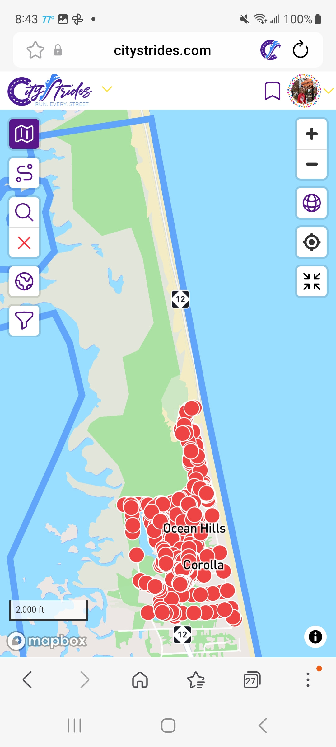
https://citystrides.com/ seems to be a bit down at the moment, so I can look at Daytona Beach, FL, USA which I recall has a beach that cars legally drive on. I think there is a similar beach in North Carolina. Since I can’t look to verify, I just wanted to chime in that sand might not be appropriate in all cases.
To see things globally, I’ll need to run a ~two hour database reset locally to see how the estimated counts change. Update: There were 9,727 Way records excluded globally with the surface != sand filter. This isn’t necessarily a 1:1 mapping to Street count in CityStrides, because a Street can be comprised of 1+ Ways.
None of these have 4wd_only tags, so that wouldn’t help us.
There’s some use of tracktype=grade5, but that calls into question whether some lingering sand tracks should exist in CityStrides (two random examples, there are a few more):
There seems to be three main areas of the island - some streets up north, some mid-island streets, and some on the south side. How do people get between the three areas?
If CityStrides uses “city” as a malleable term to describe the local place, maybe it uses “street” as a malleable term to describe the path of main transportation. I’m more in a conversational space with this one - it’s fun to think about. The varying degrees of unpaved road, what’s normal in various locations, and at what point while we’re running along do we stop & look around & wonder “really?”
I haven’t been to all parts of the island, but my recent stay was in the midpoint, which was Tangalooma (a private resort). Within this area there are several sealed roads around the resort and private residences. The only way onto the island is a ferry for 4WDs just north of this resort.
I don’t know the surface of the streets in the townships, but I would expected that they would be unsealed, but compacted.
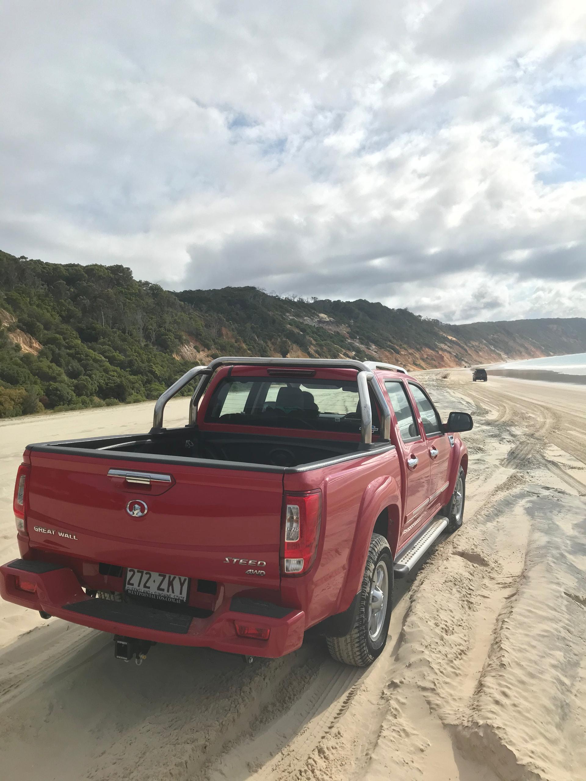
Any of the “streets” between townships or across the island are either loose sand like my photo or along the beach. These are the “unstrideable” streets in my opinion.
From your examples, it looks like some of those haven’t been marked as sand. That could be amended easily enough. Also some of these street names aren’t official council names, but just those that the road is commonly known as, but that fits OSM naming rules. There are other sand roads there that don’t have a name yet, but someone could edit to do so, as I saw one referred to as Middle Rd that goes across the middle of the island funnily enough
You’ll need to click the Run button on each page to see the result (might also need to click the magnifying glass button on the map to focus the view over them).
I think you’re still suggesting exclusion of the surface=sand tags, but I figured it might help decide if you could see everything yourself.
Thanks, James. I’ve had another look at it, and those exclusions show that there would be some editing to do in OSM to get those roads right, as it looks like tracktype isn’t used all of the time, and some aren’t even marked as sand, even though they would be.
However, I think the tracktype=grade5 is the exclusion that makes more sense, as that would (if correct) exclude the beaches and the cross-island roads, that are essentially sand highways for 4WDs. I note that tracktype is only applicable if the feature type is a “Track / Land Access Road”, so it wouldn’t apply to those residential roads on the island regardless of whether it was soft sand or not.
For others, here is the definition of tracktype 5:
Soft.
An unimproved track lacking hard materials, uncompacted, with surface of soil/sand/grass.
It’s a bit annoying that soil/sand/grass are all lumped in together. Obviously the sand tracks in your picture would be a literal slog to run/walk/hike through, but here in Portugal there are grass tracks in and in-between lots of villages that are perfectly trekkable, and even runnable, on foot. And many have names because once upon a time they were primary or secondary thoroughfares before newer paved roads changed traffic patterns.
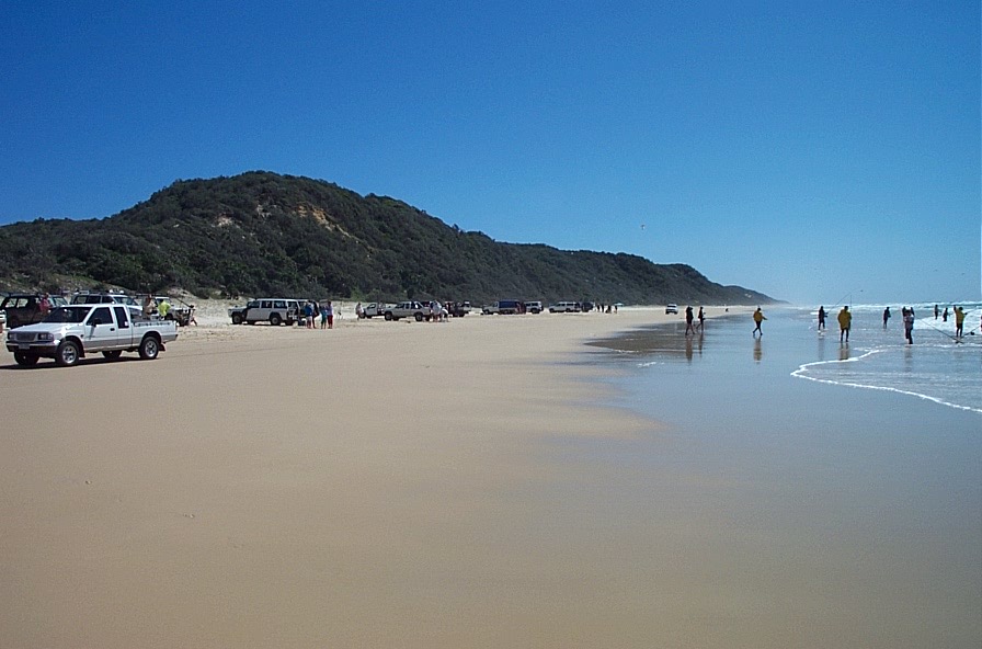
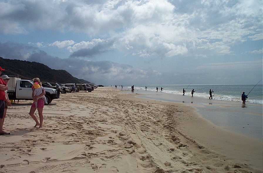
Now I’m really Curious, is beach driving such an uniquely Austalian thing that we take for granted Down Under? Here’s some photos I’ve taken over the years. These are actual legal “roads” - with speed limits, and police enforcement of speed and drug/alcohol testing and requiring a driving license and road registered vehicle! At times, there can be hundreds of vechicles on the beach! I’m not saying ALL our beaches are this busy…
Does that mean it is up to Australians (and James) to decide what to do about these sand tracks? What are your thoughts, @steveamor12 ?
We have been looking at it from a Brisbane perspective and Moreton Island. Of course, the largest sand island in the world is Fraser Island, a few hours north, and it looks like it has the same sort of thing.