I note there are a few threads around adding hiking trails in to CS, but my query is more around ones that are already in.
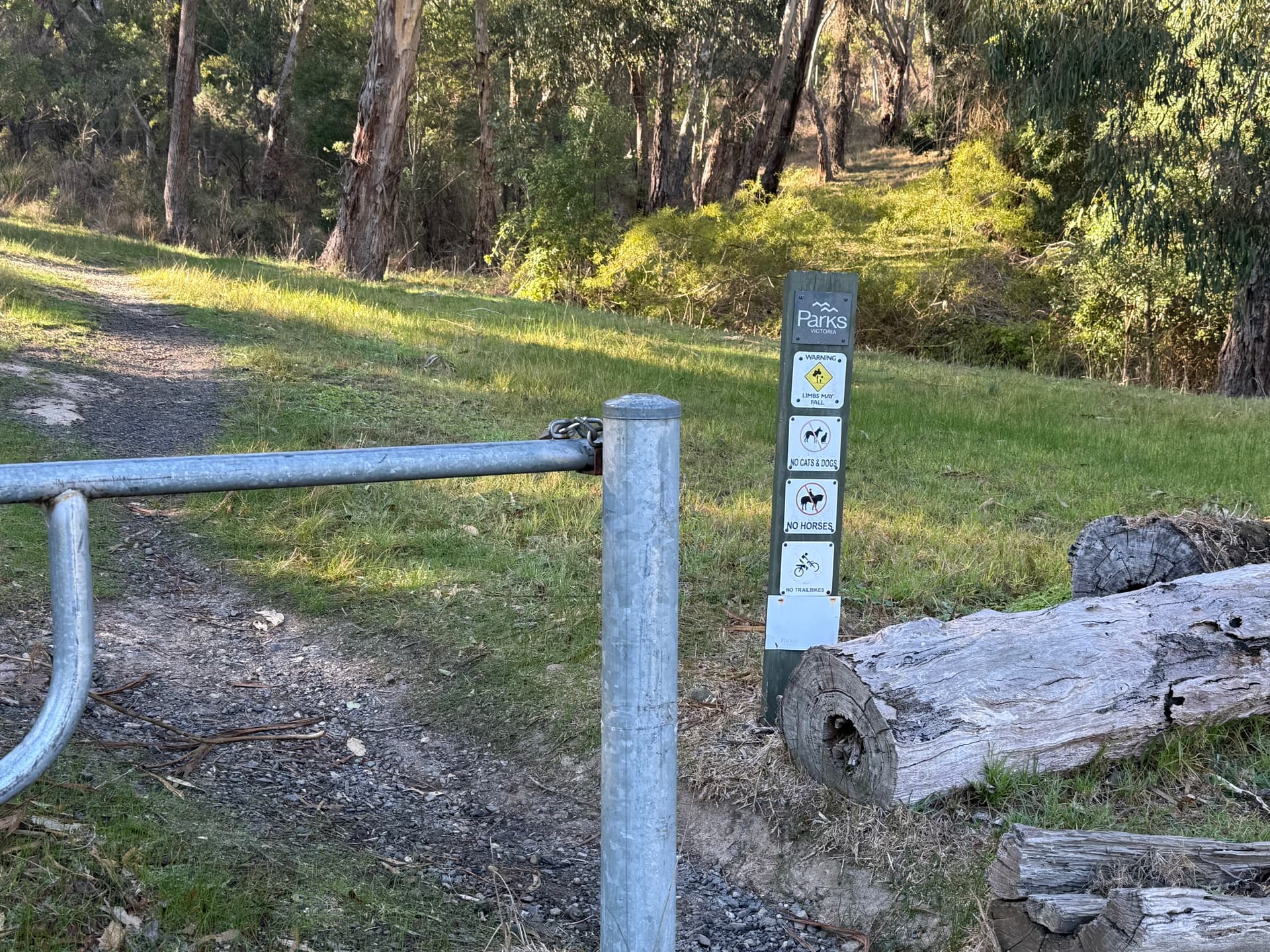
There is a national park near me that has a heap of forest management/firefighting roads throughout which are named. Where these tracks meet public roads there are locked gates with signs saying emergency access only. The restrictions are for vehicle access and foot, bicycle and often horses is ok. These tracks are marked in OSM as highway=track/foot=yes, which according to the OSM wiki would seem to make sense.
What would be the right way to tag these so they don’t show up in CS (they are definitely not in suburbia, its a steep heavily forested mountain area) without messing up OSM? I think the right way would be to add motor_vehicle=private to them, but the Overpass query currently would not exclude them?
It is unclear to me why you think these should not be in CityStrides. These are named roads that lie within a city limits, and are allowed and safe to run on. (I have run several of these in the Boston area.) The fact that they happen to go through a forested area of a city, rather than an urban part of a city, seems to be somewhat irrelevant (at least to me).
I admit it is somewhat of a blurry distinction between what is a “trail” and what is a “road” … but it seems that some authority has made the decision that this is a road.
When you say they lie within city limits, here in Australia everything in the country is within what CityStrides counts as a city because we have almost no what you would call unincorporated areas.
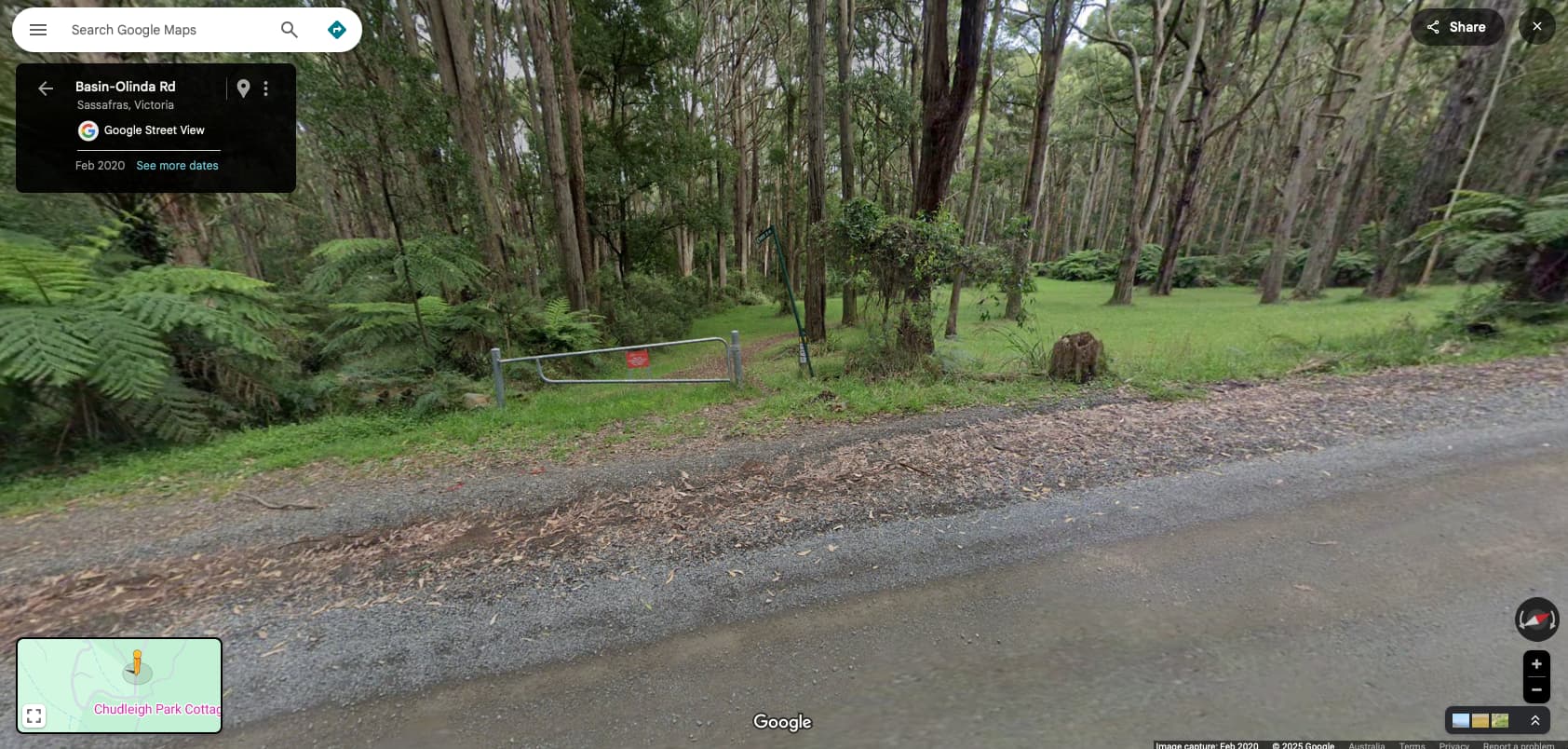
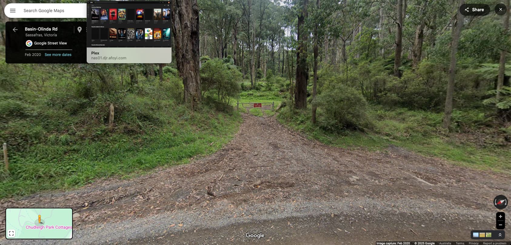
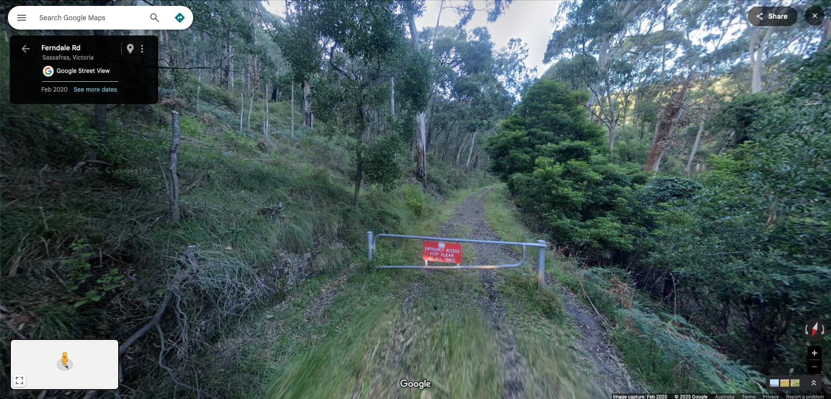
The tracks I am talking about here are in a national park and are outside of the defined metropolitan region for Melbourne, even though they are within a council area. Here’s some streetview shots of the where some of these tracks meet the actual roads:
In Sweden as well everything is in CS. Sweden is divided into 290 ’kommuner’, which is equivalent with cities. The largest one is Kiruna with 20.000 sq km. So there are a lot of rural areas, with a lot of tracks or roads which are technically not streets, but included in CS if they do have a name assigned. I don’t see this as a problem, I have no desire to “minimize” my running
The “issue”, to the extent there is one, is safety. There are hundred (probably thousands) of kms of such tracks within the “city limits” of Sydney, and most of these are essentially bushwalks. They may not be quite as muddy or rocky as the thousands of kms of “paths” also included in the Sydney city limits (and excluded from CS) but in many cases they are as isolated and present some of the same risks as those rougher paths. In many cases, there is a long section of a “track” that then becomes a “path” to complete a round trip. (In other cases, the totality - ie the track section and the path section - in combination are a one-way journey (ie a cul-de-sac).
One of the appeals (to me) offered by walking streets is that I can do it on my own. I don’t need to worry about finding a partner for safety reasons. That doesn’t apply to these tracks. There are a few that I might do on my own but very few.
Whether that is a “problem” depends on the individual outlook and circumstances, plus the nature of these tracks where you live. I’ve reconciled to the fact I am never going to actually finish Sydney so if there is a percentage of “streets” that are off-limits for safety reasons, it doesn’t leave me without anywhere new to walk.
But I understand where Darryl is coming from. And it’s slightly irritating that there are some nested suburbs (also identified as “cities” in CS) that I would otherwise be able to complete but won’t because they include a few of these tracks. Some of these suburbs are reasonable central suburbs - they’re not confined to the city outskirts - just because of how the city is nestled in amongst huge tracts of bushland, some of it pretty challenging.
A lot of the confusion from @tev4 is likely squared away via the screenshots you shared afterwards. It’s very helpful to include links to good examples - highway=track is one thing in one place and a completely different thing in another, as we’re seeing here.
The gate in front of those tracks confuses me. Where I’m from, gates like that are pretty clear “do not enter” statements. I could only read the sign in the last screenshot (emergency access keep clear at all times) which isn’t clearly stating “do not enter” but the presence of a gate certainly confuses things for me - if it’s for emergency access then it seems counterintuitive to require stopping/unlocking/opening in that moment it’s needed.
I can’t full-send a block on highway=track because of how it means different things in different places. I did just work through a way to treat highway=trunk differently across various countries, so I think I could apply that logic to this track tag as well. I’d really like to have a bigger conversation - with examples and links - before I made that change across all of Australia … are there any cases where highway=trackis a road?
I’m looking at these screenshots and feeling that these are very firmly not in the spirit of CityStrides. Maybe you can run them, maybe it’s fun, that’s awesome I bet it’s a fun and rewarding experience - but those screenshots are visibly an entirely different thing from the spirit of “run every street” (which has some odd edge cases, to be sure).
Thanks for tagging me, James. The screenshots above and further elaboration definitely helped clarify the argument for removing these.
An example of a safely runnable highway=track near me is Coal Road in Belmont MA. Here is a link to OSM, and here is a link to Street View that shows a similar gate situation. It is clearly a “land access road” (which seems to be an important possible distinguishing characteristic for track?). In my experience, these gates effectively mean “(1) Pedestrians welcome (often there is a path); (2) No public car access allowed; (3) We need emergency vehicles to be able to get in.” I would also add (again, just my experience), that the track roads near me have more of a feel of “drivable trail” than “pedestrian-able road”. I would not consider it a bad decision to remove the ones I know.
I hope that helps a bit! As always, thank you for your thoughtful approach to the site.
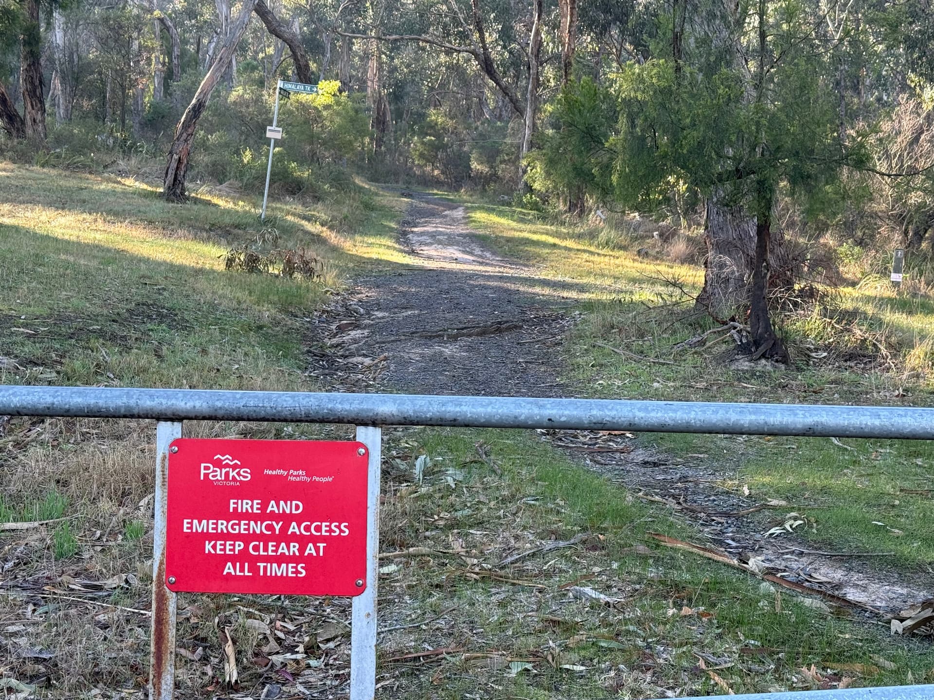
Without commenting on how “highway = track” is used in practice in different places, this is the guidance from OSM wiki on when to use the tag.
My understanding (or guess) re the gates in front of many of these tracks (at least here in Australia) is to prevent non-emergency vehicles from using them. I suspect most (all?) are navigable by four wheel drive vehicles, albeit some would make for a rough ride. For those designated as fire access tracks, they clearly need to be navigable by vehicle. I don’t think they are intended to prevent pedestrian access, nor is pedestrian access forbidden. So it is entirely possible and legal to walk them.
It’s more about whether they fit into the spirit of streets that CS was set up for.
These gates are so firefighting vehicles (either light trucks or 4WD style vehicles) can access into the area. They are locked with a common key that the firefighters have. In the context of a multi-day firefighting activity a couple of minutes for the first crew to open the gate won’t make much difference. And note that these tracks are mostly for fire, they are typically not used by police/ambulance.
That was my feeling. I have walked all the paths/tracks in one nearby national park and am also planning on walking all of the ones that I linked, but that’s separate to CS.