Hello, brand new to site. I searched but could not find what these “Nodes” are or what they mean. Thanks for you help!
Nodes are the points that make up a street. So if you’re on this street … Shindehogan Road in Heritage Hills, New York - CityStrides … all those points are the Nodes.
The name comes from OpenStreetMap, where I get all my city data. They call them Nodes, so I did too.
Hello James,
Thanks for the reply. So my next node related question is this…I have run the entire length of this road:
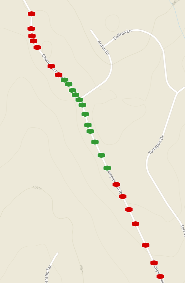
enter link description here
But only 39% of the node lit up, not giving me “credit” for the street. Is there something I am doing wrong or should be doing differently? I would really not want to run a few of these roads more than once!
Thanks you, Kevin
Hey Kevin, no problem!
I think the problem here is that my system for all the calculations is very distributed, which is causing a lag in giving you credit for having completed the street.
When you’re viewing the street page while logged in, are there any red Nodes displayed on the map?
@jeep68 I’m a newbie and trying to understand nodes. If I’m looking ahead for a walk/run, can I assume from your discovery that if I see red nodes somewhere, I will probably not be able to walk/run there (due to it being private or woods, etc.)? Thank. I read the wiki entry and searched it for “green” and “red” and didn’t see anything about the colors.
@shawnwistrom Good find. Anyone can edit the wiki, so if you find an area lacking, you/anyone can make it better.
No, a red node means that you haven’t run that node. Usually red nodes actually are on runnable roads, so just lace up your shoes and go for it.
Occasionally you’ll find that what looks like a road on OpenStreetMap.com is actually either non-existent or unrunnable. (Do NOT run down an Interstate Highway just because it’s got a red node.) In that case, you can do one of two things.
First, if all the remaining nodes are unrunnable, you can manually check the street as completed. Second, you can enter the intricacies of OSM and correct the map. In some cases where the street doesn’t exist, you’ll need to move and/or delete the street. (Be careful. Driveways are included on OSM. Just change the category.) In other cases, you’ll need to change the access for the street to indicate that pedestrians aren’t allowed. In even other cases, you’ll need to insert a gate and mark all the streets on the other side of the gate as private.