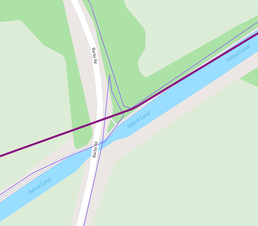
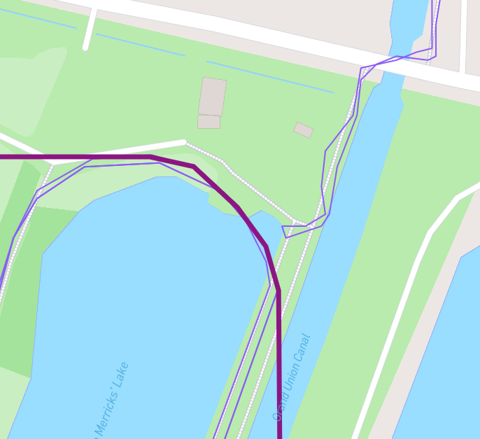
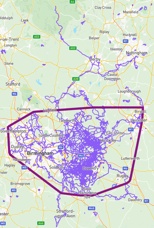
Hi James, I love the new territories feature but please could you build in a small gap tolerance? As you can see from the attached images my main territory should be much larger.
Thanks, Elliott
I’d vote for this as well.
Doesn’t necessarily break my territory any longer (went out already and reran 2 sections to connect lines), but could see it happening again in the future during longer multi-day runs if I stop and start on different sides of a campsite or sidewalk.
I don’t agree! I found several gaps like that around Stockholm, just gives my a reason to go back and fix it​
And it gives me one more thing to be careful about next run!
I do think that it makes sense for there to be a tolerance equivalent to the GPS trace tolerance for capturing a node, to hedge against the actual path overlapping but the GPS trace having been wonky. (That’s 25m, as I recall.)
I don’t know how difficult this is to implement in practice, though, so I’m not sure if it should be a priority.
I would be nit-picky here and say that if I started on different sides of a campsite or sidewalk, and my true path did not overlap, I would not want those territories combined. I would only want the tolerance implemented because the GPS trace may have drifted from my true path.
An alternative that handles both concerns might be a “merge activities” button, similar to OSM. If there was a way to select both runs and then click “merge” (while still maintaining a max allowable gap) then each person could fix gaps at their own discretion. I have one tiny gap in western Australia that I doubt I’ll get back to fixing!
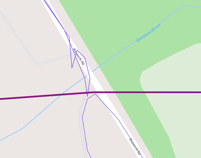
I agree that a territory should be expanded if adjacent activities are within GPS tolerance (like 15/25m). If it’s a narrow country lane I’ve never considered running from side to side to ensure adjacent runs “overlap” - that seems a bit silly
![]()
I agree withTim here. Zero tolerance! I’m right doing several runs to connect my territories around Stockholm. Some are really close to each other, others a bit more off, but it’s a fun challenge. And from now on, of course I will keep this in mind for new areas​![]()
Zeno’s territory gap
Do either of the activities have large gaps (that straight-line thing)?
Which Territory is that a screenshot of?
Your Territory 7 also looks wrong on the east side…
Territory 7 is correct in the East, actually. Incredible yes, but there’s legitimate tiny gaps the entire way. And some highways I haven’t crossed.
This little territory 195 ( Territory of Mitch LeBlanc - CityStrides ) is the only one that looks a bit buggy that I’ve found. It’s nested inside my large overall city territory 7 (Territory of Mitch LeBlanc - CityStrides),
As for large gaps, no, these are regular walks on max GPS accuracy and 1 s recording. Zoomed out view:
What about someone doing an FKT type attempt on the Appalachian trail? They’re not NOT running/ hiking that stretch and aren’t magically teleporting a few feet, but maybe they stop the watch for the day, set up the tent, then when they restart the take down the tend from the opposite corner and start from that side? They were still there and covered the distance, on foot.
![]()
The database does not see these two as intersecting - it says they’re 0.75073487 meters away from each other. The wrong-answers-only machine is taking the database’s side (
of course).
@JamesChevalier - is there a plan to add “tolerance” to the territory calculations? It feels a little inconsistent to be able to score a street-node with 15m tolerance, but absolutely zero tolerance on the adjacency of two activities. All of my biggest territories are truncated prematurely (IMO!) where two activities fail to meet by less then the width of a single-carriageway road (i.e. less than 3m).
But did your actual footsteps cross? Territories are accomplishing something a bit different than checking off nodes. I understand wanting tolerance for gps error, but if you were on opposite sides of the same street and never crossed, that should not link together.