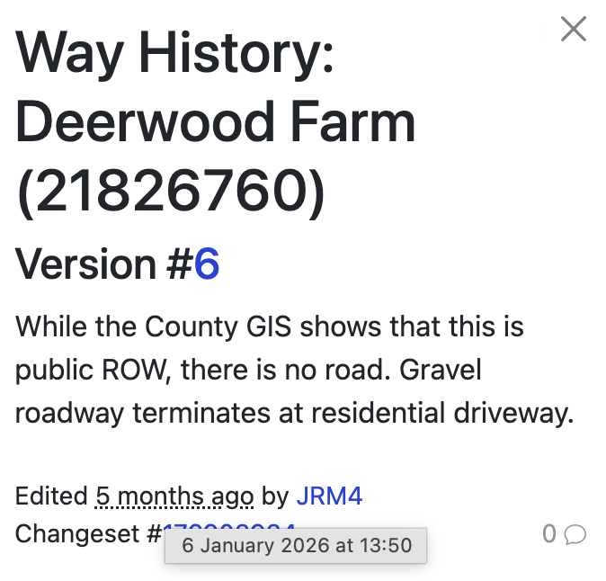
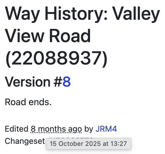
Got an odd one. I think both of these situations are where I fixed OSM (roads didn’t go where they were originally mapped.), but one of the incorrect nodes still lingers in CS.
The first is Deerwood Farm in Wayne, IL. The second is Valley View Road in Addison, IL. For both I fixed them a while ago (maybe years at this point) and both have been updated here since the fixes. Not sure with the Addison location, but the Wayne location was correct here, but then after an update, the old incorrect node came back.
Both locations appear correct on OSM.
Any assistance anyone can provide would be appreciated.
For Addison I don’t know because the city was sync’ed the 5th January too, but you have made the edit on OSM the 15th October 2025. Maybe try a sync and maybe it will work.
Yeah, Capi pointed out all the correct details.
I don’t have insight into why the node wasn’t removed for Valley View Road, and I’d also suggest a resync to see if that sorts it out. If it doesn’t, I can manually work things out.
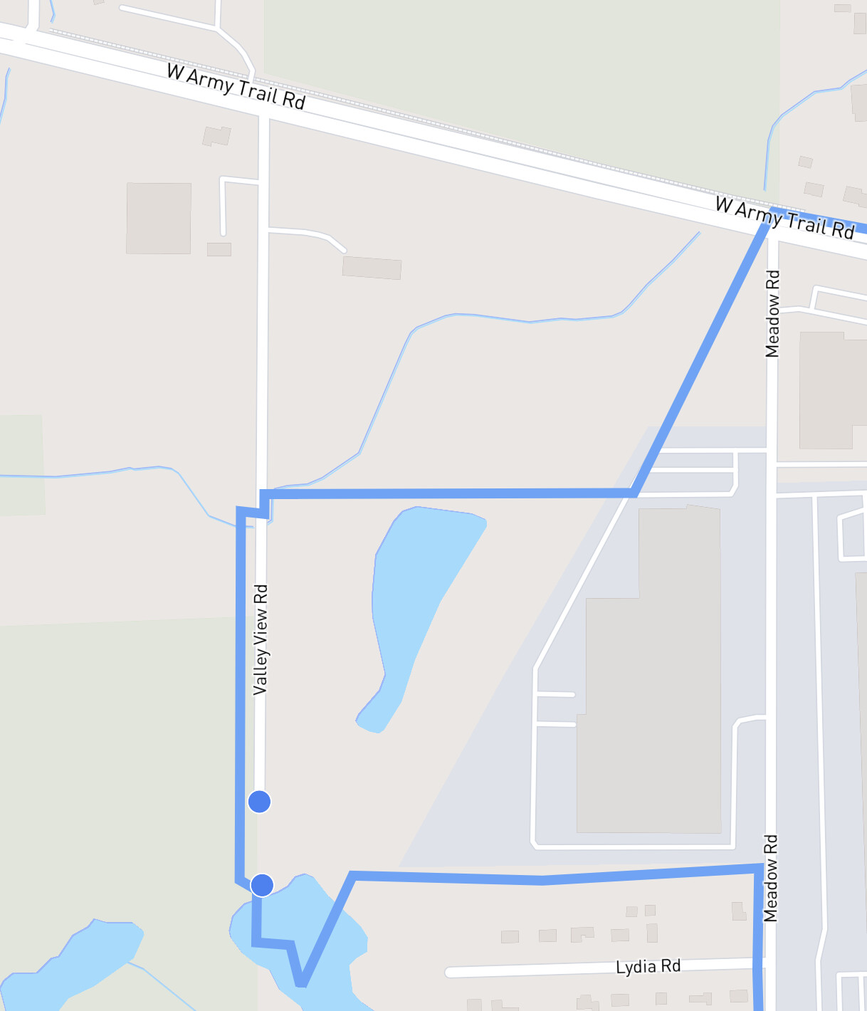
In addition to the edit for the street ending earlier … Valley View Road could probably use some additional nodes on the city border:
I’d suggest double checking node placement in the northern section of the street that’s within the city border. Maybe there are no nodes until the intersection of West Army Trail Road … maybe the nodes that are present are on the other side of the border. Either way - you could drop a node on the border (like zoom WAY in and get it exact) to help make that more accurate.