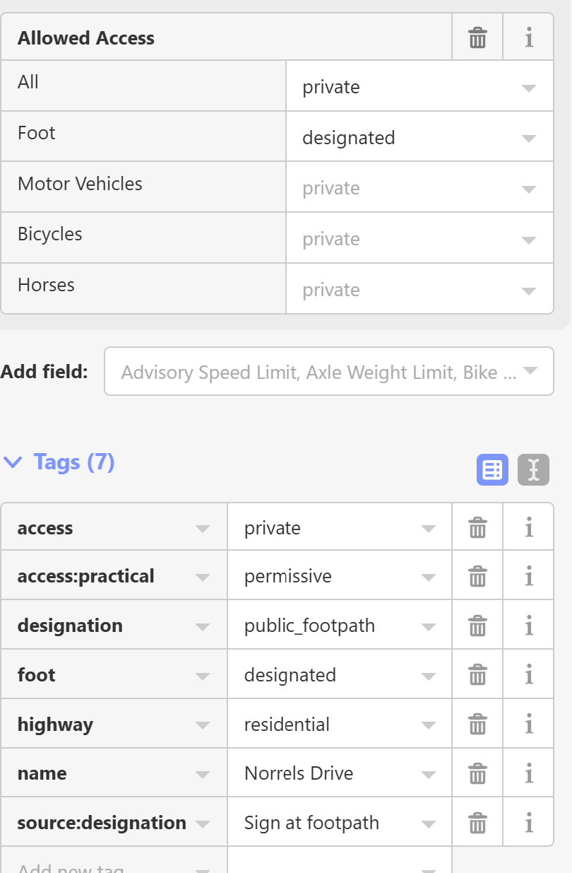
How does CS handle situations where the mapper has put a default access=private then overriden with things like foot=designated or even foot=yes where it might be a “private” road in terms of being private for cars but has a public footpath over it so running/walking it is 100% fine.
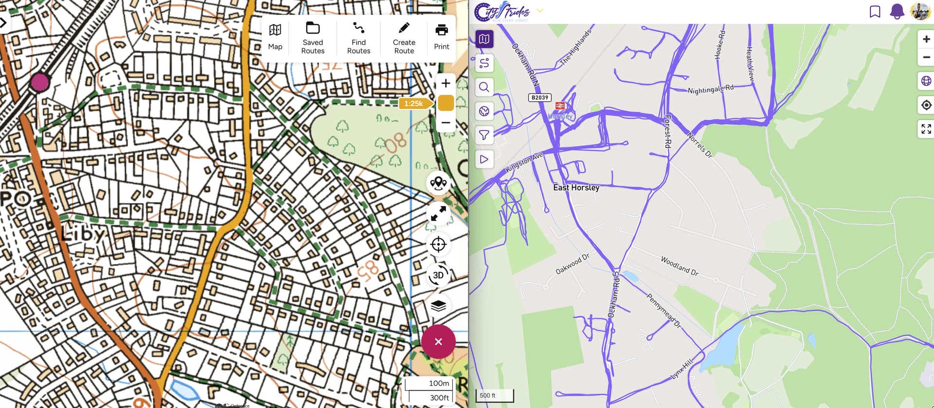
Good example is Norrels Drive in what would be in Guildford city in the UK. The green dashed lines indicate public footpaths over what are residential Tarmac roads albeit with Private Road signs over them. No we can also debate the very conflicting access in OSM meaning either what you can physically do (locked barriers/gates or not) as opposed to “owns” the road.
My hunch here is that CS code is overriding foot=designated with access=private and excluding the road whereas I think it should be the other way round ?
So rather than trying to go and retag this to “suit” CS but probably upsetting the local mappers, what is the story here?
top access private or no immediately removes the street from CS. A foot=yes below that has no impact. I seem to remember that StreetFerret is the other way around, foot access takes precedence
Thanks. I ran it just now. Nobody complained Think this should be one that CS includes as surely the point is what foot access it has. General private access does not make any sense here anyway really given it is a public path. Kind of implies the default is for vehicles only. Guess issue in s car you aren’t going to access it unless had business there but access is not physically restricted although there are private road signs. Think here best to remove the general access and put explicit entries for each type. Or the CS query is wrong. And yes Street Ferret does include some of these.
Just revisiting this has come across another access=private, foot=yes street that is excluded from CS as foot=yes is ignored given the access=private even though I “think” the precedence is that foot=yes becomes the exclusion.
Anyway one of those tricky ones where the road is gated for vehicles so clearly private but “everybody” walks along it. Strictly speaking it is a road of private ownership.
I feel it “should” be on CS but at the moment would need to set permissions on a per type basis. It is one of those “questionable” ones where foot=yes is not “technically” correct but there is no physical restrictions for those on foot and indeed even a “gap” next to the gate is provided. So it is sort of foot=permissive and probably bicycle=permissive but I don’t really like adding permissive unless an actual sign says so.