I have walked all streets in my hometown Alkmaar (Netherlands) but I’m left with 12 non-walkable streets. I hope someone can help me to correct the map so I can claim 100%. These are the issues:
Emeriantianahoeve: there is no street with this name. Emeriantiahoeve is a monumental farm but not located on this unpaved farm road with sign “access denied”
Amperestraat & Voltastraat: these roads are partly closed by gates because of a construction area. The large office site (PEN-dorp) has been closed for years and access is denied.
Huiswaarderweg & Kooimeerplein: there are nodes on three gas stations but these are only accessible by car.
Ommering, Steve Bikoweg, Provincialeweg, Schagerweg, Nieuwe Schermerweg: these are (partly) multilane highways, no slow traffic allowed (except for agricultural)
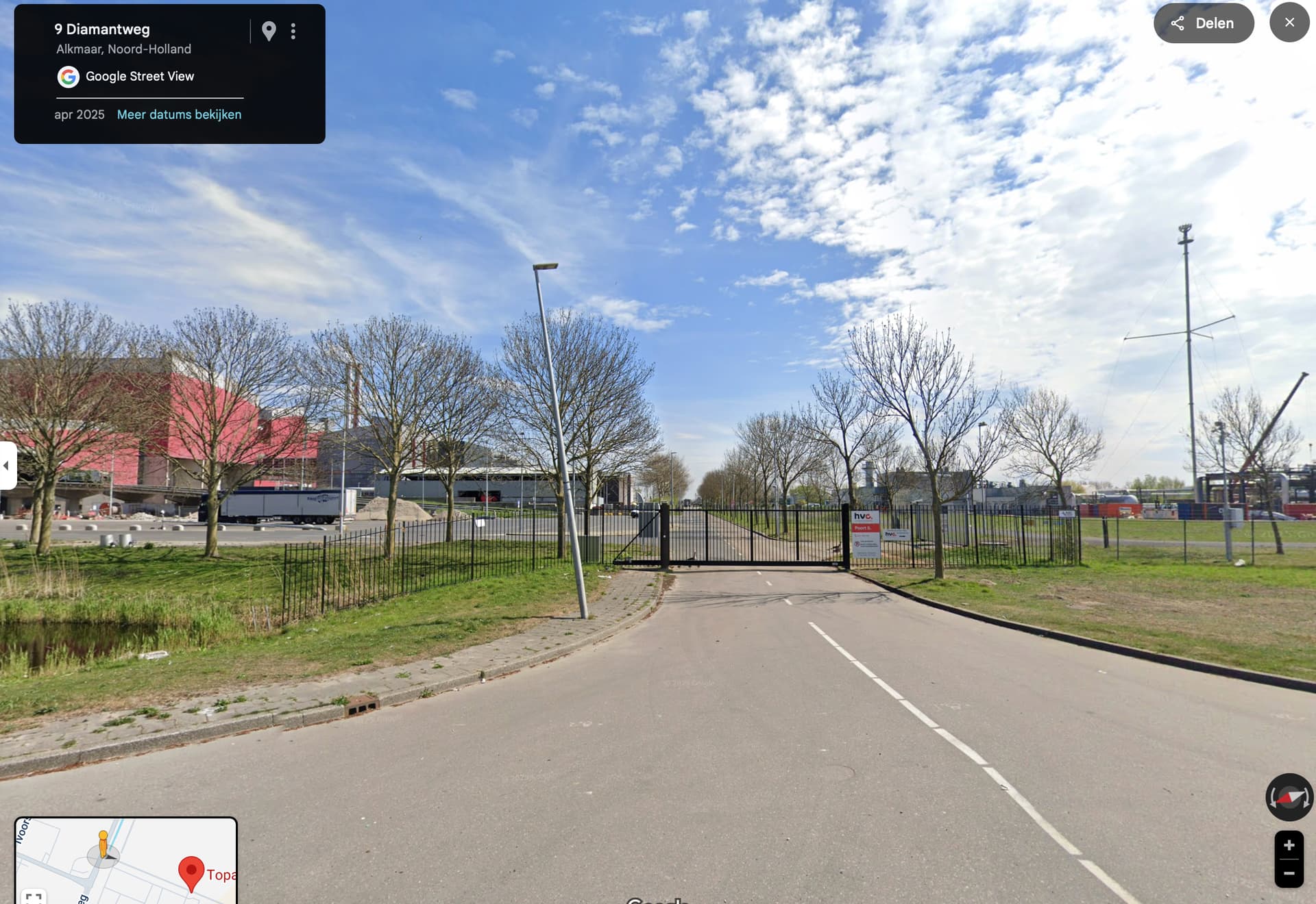
Topaasweg: this road has been closed, is now part of the recycling facility. There is a gate.
I do hope someone (mapper) in my region can help me with these issues. Now walking Amsterdam!
Thanks Patrick, all issues solves except one: Topaasweg. This road is now part of HVC, since the construction of the Olivijnweg. There are gates on the east and west side of the road, only 200 meters or so on the east side are accessible. Situation is fairly recent, not yet visible on street view. The 5 red nodes in my profile are on the closed section of the road. Thanks again!
regards, René
Thanks again Patrick! If I’m right I can only sync once a week to make the change visible. In the meantime I will hike and hit the last nodes on two remaining streets since the last sync.
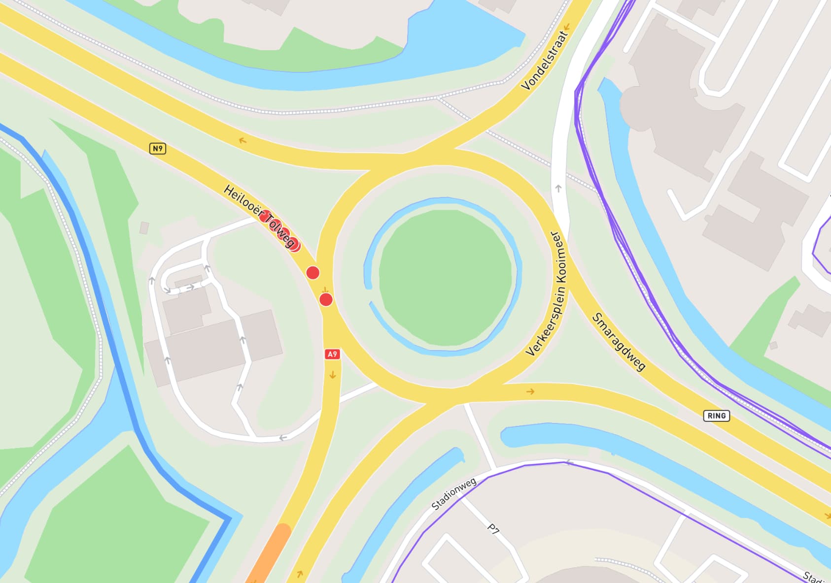
All the previous issues have been resolved so I was hoping for the 100%, but now some nodes appeared on the Heilooër Tolweg, in front of the gas station. This is the on-ramp to the A9 motorway and definitely not accessible for slow traffic. Can Patrick or any other mapper correct this?
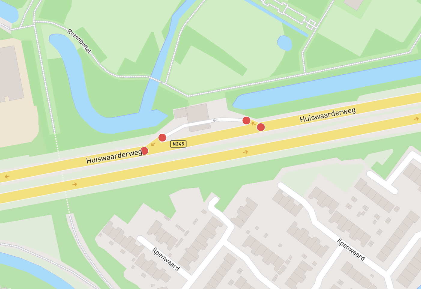
Alkmaar has been updated, a few nodes added to existing streets but also 4 nodes added to the on- and offramp of the petrol station on the Huiswaarderweg, where only motor vehicles are permitted. Can anyone change it back to motor vehicles only?