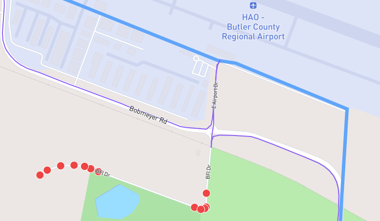
I’ve run 656 of the 657 streets in Fairfield, Ohio. The one street I haven’t been able to run, BFI Dr., is a gated private road. This can be seen on the Google Maps Street view. There is a fence with barbed wire and a locked gate with a sign across it saying to not enter. Can you mark this as a private road and remove it as an accessible road?
Thanks!
Doug Schneider
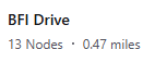
Just following up on this one. As mentioned, I’ve completed running 656 of the 657 streets in Fairfield, Ohio. The one street I haven’t been able to complete, BFI Dr., is a gated private road. This can be seen on the Google Maps Street view. There is a fence with barbed wire and a locked gate with a sign across it saying to not enter. You had replied that you were setting the road to private, but there are still 13 nodes showing as not completed on BFI Drive beyond the gated fence that are appearing as not completed on my map.