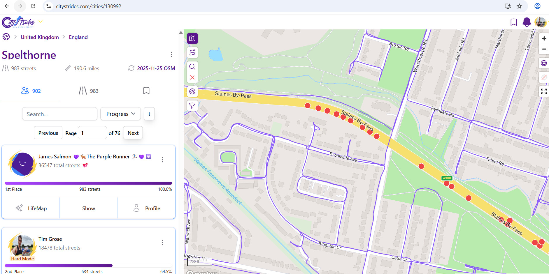
What would your tactics here be? This is a dual carriageway that has a pavement/sidewalk to the north side only in the part have done so far. There are nodes on both carriageways. When the path moved slightly away from the dual carriageway it was because the dual carriageway was about to go on a bridge. Pedestrians are basically supposed to go “under” the bridge on the path was following. I got “near enough” to get the nodes on the north carriageway but not the south. When the path was more “alongside” the north carriageway I got the nodes on both carriageways.
Now in CS terms you can’t “really” run the actual road only the sidewalk to the side of it which is effectively a separate way.
I might be able to (with care) stagger up the grass verge here but that does not seem sensible at all. It is one of those parts of a road where foot=yes is “technically” correct (even on the actual road) but practically foot=“you would be stupid to try” is more like it!
I have some similar issues in Japan. When there is no pavement I tag the non-runnable side in OSM with foot=no.
This might be relevant - Change foot=no handling in street filter - or maybe the “if it has a sidewalk” aspect from that idea could be applied here. Can you share the OSM link for that street (or any one of the relevant Way records, if there are more than one)?
This is the path Way: 915904462 | OpenStreetMap that diverges a bit too far from the most southerly carriageway of two and so I missed the nodes on it.
Hm, yeah, I’d probably go with marking it as manually complete … I’ve got an update on the way that’s going to enable this for people using Hard Mode.
This is definitely a case of trunk road that I’d prefer to exclude.
It’d be painful to code up a “if maxspeed too high and no sidewalk present” filter, because the maxspeed value isn’t a number, it’s text … I’d effectively have to filter for all possible values (50, 60, 70, 80, etc) in addition to mph/kph or however it might be tagged.
Would it be possible to give these nodes a larger ‘hit’ area? I believe the standard is 25 metres, I’m not sure what it should be to get them to complete though. In theory, a node could be in the middle of a multi-lane section, so the sidewalk would be separated by a few lanes, a middle shoulder, another multi-lane section, a shoulder, possibly a cycling track (I live in The Netherlands). And then of course there is GPS wobble.
Max speed isn’t necessarily always going to work either as sure have seen places like tunnels or just more “urban” roads that say only have a 40 mph limit but still excluded (or not meant for) for pedestrians. Also, round my way, a major intersection with the M25 motorway and A3 trunk road has been upgraded and no pedestrians/cycles/horses signs have appeared on the approaches on the A3 (which previously had adjacent sidewalks in the main) so 100% correct to mark those sections as foot=no. Replacement foot/cycle paths have been provided but they are effectively separate ways and, in parts, some distance from the road. I have turned on “Hard Mode” as I like to try and do everything but equally there are roads like in my example where clearly pedestrians are clearly not supposed to go even if not 100% legally banned. I think if I “have to” use this in the future than the logical assumption is mark as foot=no on OSM and if see anybody “complains”. Maybe they would like to walk/run those parts and report back…
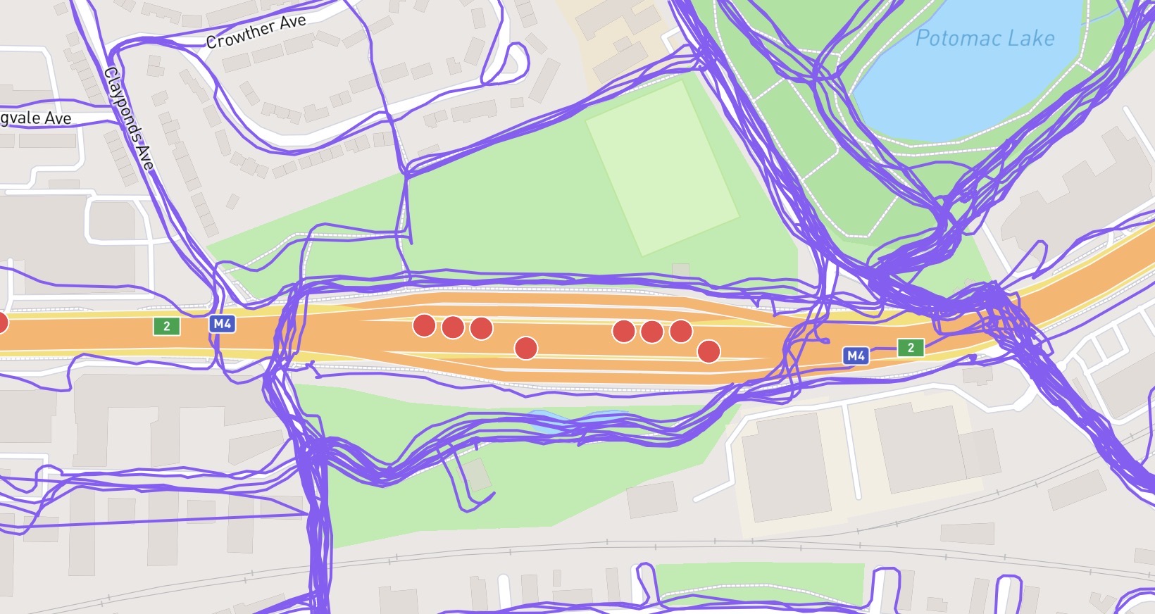
I’m seeing similar with these type of roads in Suffolk. I believe the solution may be to set the expressway=yes tag on OSM.
Based on the definitions of an expressway on OSM it looks perfectly valid for the A308 (name=Staines By-Pass). Looking at the Overpass Turbo query it appears these expressway=yes nodes will be filtered out.
I think this will solve quite a few cases in the UK that are technically legal to access on foot, but are not remotely safe or sensible to run along.
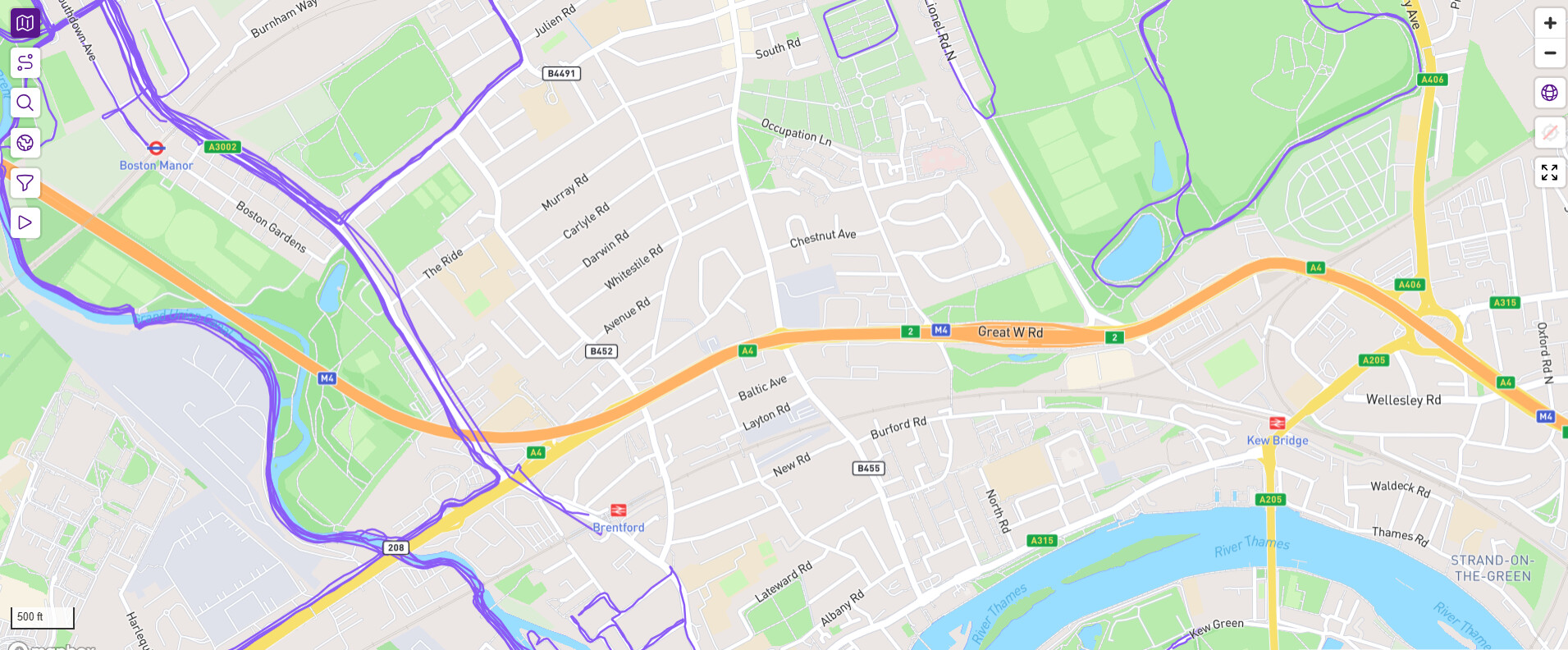
Ah I know that one. I grew up in Hanwell near Elthorne Park so not far from here. Might well get round to do more of Ealing for CS for nostalgia! My mum still lives there. Odd setup there as the M4 goes over the top of the A4 which presume the nodes are for. Street View suggests can run on the central reservation as quite wide. Just hope get a GPS signal ![]() I see that as more of a “challenge” than something significantly dangerous especially as there are pedestrian crossings across it.
I see that as more of a “challenge” than something significantly dangerous especially as there are pedestrian crossings across it.
It would be nice if there were a general way to tag modes as “difficult” or “not easily runnable”. I’ve ran into a few other cases where a road has a sidewalk that is a good distance from the road or the crosswalk is on only one side of the street on a very wide divided low speed road.
Another case I’ve seen is “covered roads”. The section is technically runnable, but difficult or impossible to get a good GPS signal.