I feel like I should know this, but I don’t. I have not enabled hard mode, but I do all my striding in a self-imposed hard mode.
But what I can’t seem to figure out is, how do I see all my streets, for a given city, that are completed, but not 100%?
I thought node finder would show these nodes, but it doesn’t seem to be working that way, unless it’s related to some of the problems @JamesChevalier has been posting about?
I think Node finder shows you your incomplete streets. So if you‘re not in Hard mode that means streets less than 90% complete. If you want to see also the ones at 90-99% just enable Hard mode. That’s just how it works. I can’t see any reason not to use Hard mode
Thank you Hans. I don’t know why I’m so reluctant to enable hard mode. I think because I want to know I can finish a city, even if the OSM data is not 100% accurate, yet. Perhaps a hold-over from the dark days before city updates were possible? I think I’ve only only manually completed 2 streets, and that was more of an experiment.
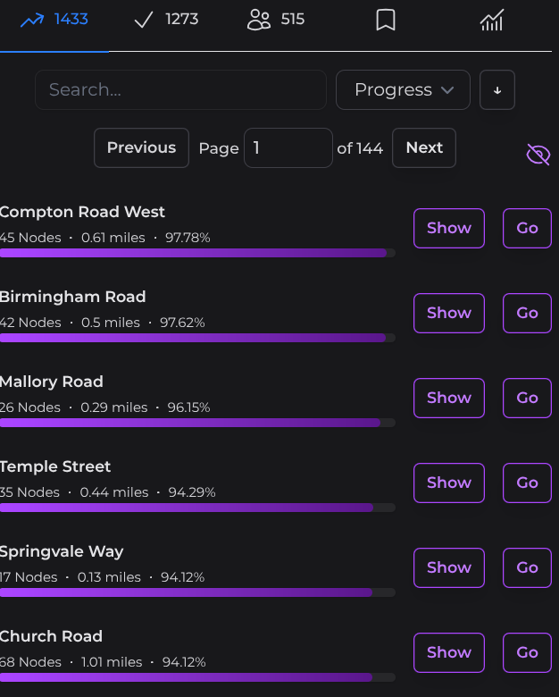
Go into a city you are working on, click on the unfinished streets mark at the top and then pick “progress” from the drop down menu that gives you sorting options. You can then chose to sort in either direction.
Thanks Liz @ericjrw I hope you find it useful. I get annoyed with myself as I now have to drive back to these places to finish them. I do CS while walking my old dog hence the drive - walk - drive home plan.
@liz So I think my problem is every street in my current city, Eric Wes is running Erie, Colorado - CityStrides , is at least 90%, and thus complete. I’m trying to figure out if I missed any red nodes, but NodeFinder also considers all streets complete. I think the only solution is what @hans1 suggested. Considering I’m just visiting Erie, I think I’ll take my win and work on something else…
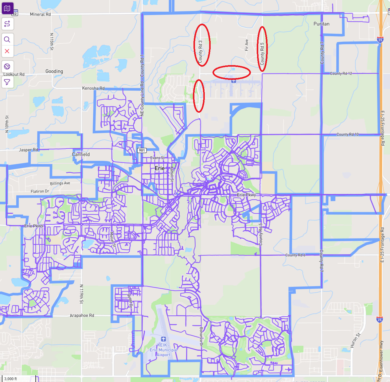
Which has me pondering, more progress on another city, or more purple lines on my LifeMap? Erie has this one mile by one mile grid, and I kinda like the idea of getting the grid on my LifeMap.
Oh, and the circled roads are not in Erie. The north (and NW) boundary of Erie is actually a double line, so that the road (CR52) is Erie, but the area below is not. As you can see, I already have some purple lines in the area already. I think my LM would look better with more of the 640 acre boxes.