I love looking at mine and other folks’ lifemaps. I think it’s even cooler than the street counts and rankings, etc. Sometimes I want to look at the big ol’ area that I’ve run and compare it to someone else’s home turf in another city, region, or country - or even in different geographical areas of my own lifemap. But I don’t know the relative sizes of cities or regions.
One bulky solution to this is to open two browser windows, zoom to the same scale, and admire…but it’s rather clunky. For example: two areas I spend a lot of time, in Lisbon and a more rural area of Portugal, at the same default scale factor - but if I want to zoom in further on one, I’ll have a difficult time matching in the other pane…
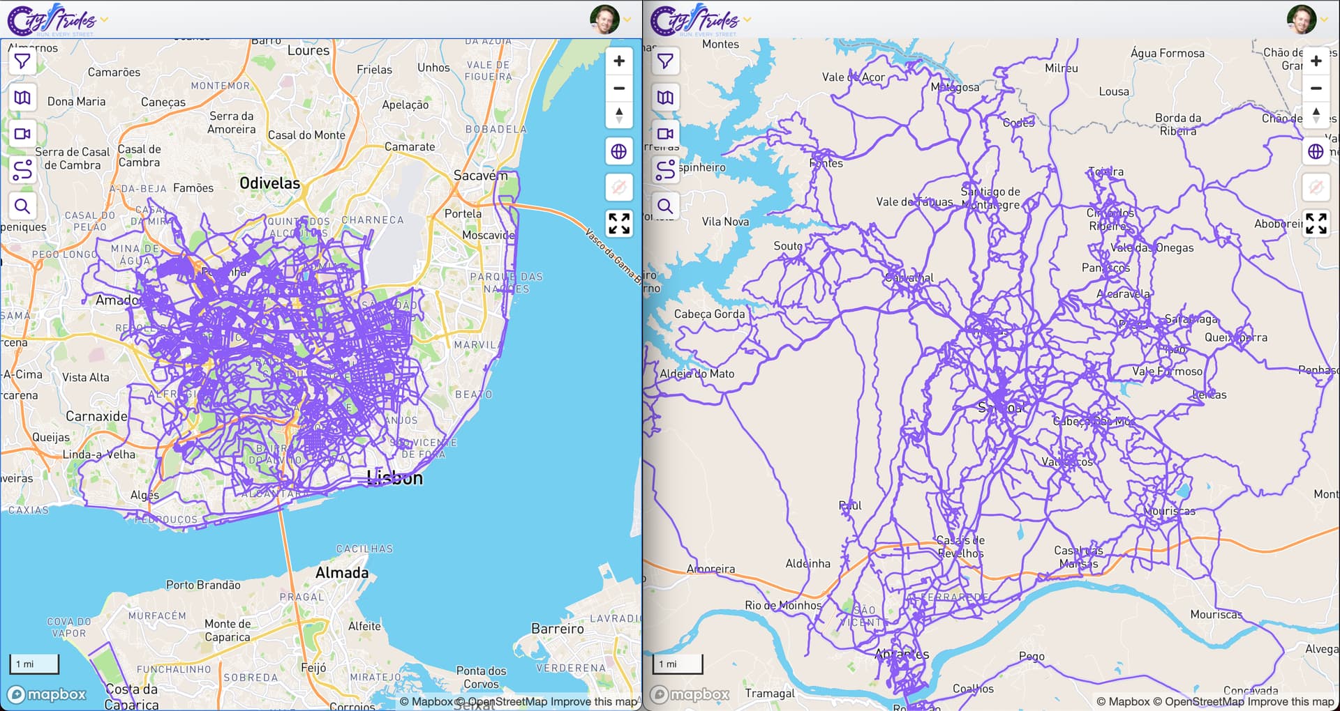
What if there was a menu option to compare lifemaps: brings you to a new CityStrides page with two embedded side-by-side windows. The first window is your lifemap, the second has a bar at the top to input another (public) user’s ID, or your own. It loads their default location, and you can pan separately in either window (and/or have a drop-down of user’s city list ranked by completion), but zooming in or out in one also zooms in the other default - ie, the scales are mirrored.
I think this would be so neat to see what lifemap coverage in rural areas with wilder purple lines looks like compared to dense gridded cities. Note that I considered Overlay two people's citystride map view and I also think that’s a great idea for comparing same-city/region lifemaps; this idea is complementary but quite different, I think you’d agree.
