Yesterday I synced the map for Columbus, Indiana. Now when I view the city map, I see blue boundaries underneath the purple boundaries that I’m used to seeing. On the map, you can see both colors where they don’t overlap. Did the sync pick-up areas annexed by the city since the last sync? If so, how soon until these 2 boundaries also sync?
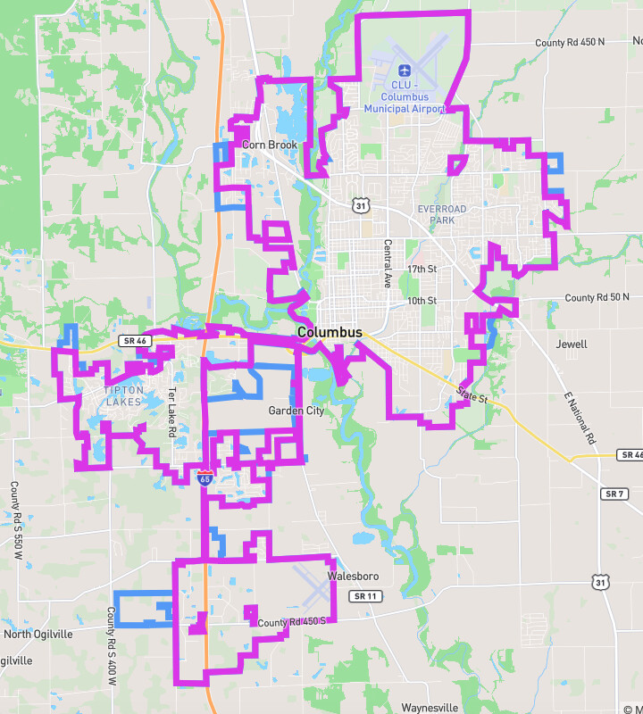
Ugh, so, the global border view that you get by clicking the globe button on the map (the purple lines) are updated separately & on a different schedule (read: no schedule  ) from the individual borders (the blue lines). I’ll queue up a global border rebuild now & figure out a nightly schedule for that, since cities are updating fairly quickly now.
Thanks for the clarification and for queuing up the rebuild!