I’m not sure if this has been raised before, but I’ve recently come across a couple of examples. Essentially, the city boundaries don’t align with where the streets think they are.An example is Strathfield South Mel Cox is running Strathfield South, New South Wales - CityStrides, where a number of the streets within its boundary are shown as being in Belfield Belfield, New South Wales - CityStrides, the city immediately to the south. An example is Elliott Street - CityStrides, Elliott Street, which appears within the boundary of Strathfield South, but is listed as being in Belfield and does not appear in the list of streets for Strathfield South.
I’ve noticed the same thing. This happens to me on both the City view and Challenge views. Here’s a screenshot from my personal progress on a challenge page:
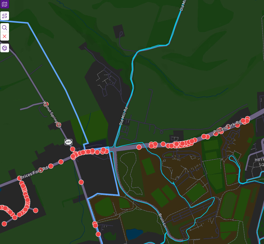
The City/Town is Blacksburg, Virginia, USA. This is on the west end of town, and the town boundary can be seen as the thick blue line, the thin blue lines are my running routes. The nodes on the right should be showing up, and the nodes on the left are not part of the challenge and shouldn’t show up. This happens along all the edges of my town map as I search for nodes.
Some links in case it helps you troubleshoot:
my user - Jon L - CityStrides
The challenge from above - Challenge: Blacksburg 2026 - CityStrides
Approximate coordinates from map - 37.215, -80.465
A sync has cleaned up Belfield. Strathfield South is still syncing. If there are others, I can sync those as well.
The Challenge thing is a totally different issue. That’s just a bug where it isn’t limiting the nodes to within the city border. I’ll look into that today.
Thanks James, those two cities look good now. The other example I came across is Sydney Olympic Park Mel Cox is running Sydney Olympic Park, New South Wales - CityStrides and Wentworth Point Mel Cox is running Wentworth Point, New South Wales - CityStrides. There are a couple of new streets in the north, eg Guwali Street: Guwali Street - CityStrides.
Looks like someone has (fairly) recently changed the boundary of Wentworth Point. I walked a couple of those streets to the west of Hill Road a while back, before Guwali street existed. I was surprised to see them show up under Sydney Olympic Park rather than Wentworth Point. But I see now that that area under developed has been incorporated into Wentworth Point, which makes far more sense from a suburb cohesion perspective.
It seems that this was an official boundary change that was gazetted in 2023! Took a while for OSM to catch up….
I’ve noticed this on a few small towns in my area. Is there a best way to get these cleaned up? I’m new to CityStrides so apologies if this has already been answered elsewhere. Thanks
This should not be happening. Can you share links to affected cities?
I’ve only ever noticed this for cities that have no striders and haven’t been synced in ages. I was looking at the longest streets in Indiana and thought there were some oddly long ones for places I had never heard of.
Here’s one example:
Oh good! Those are excluded from syncing, so that issue wouldn’t be automatically cleaned up.