Add a route suggester/builder

Great progress!

FYI, on my machine (Chrome on MacOS Big Sur), the Route Builder controls lie on top of the map zoom in/out buttons, which are therefore inaccessible, as shown in the attached image.

And, since I am here mentioning the zoom in/out buttons – I would love it if those were a little bit lower on the interface. When I move my mouse to those controls, I find that I often accidentally move over my profile pic, triggering the menu with Lifemap, Profile, etc. (But maybe that’s just me.)

Yeah, I noticed that. Odd - locally it doesn’t do this for me. I’ve got some minor changes I plan to release soon & I’m hoping that’ll take care of it. :crossed_fingers:

The trouble with lowering that container is on mobile - it’s already a crowded space. :confounded:

Update: my changes broke things differently :angry: … I’m still trying to figure out why it works locally but not on the server

1 Like

I mean… I guess the new version is slightly better than the previous version. :stuck_out_tongue_closed_eyes: If you are in to new, sleeker functionality and all.

If you want nitpick things, may want to differentiate the hover / alt text for the route type toggle. If you hadn’t mentioned in release notes that we could switch between road snapping and straight lines, I wouldn’t have looked for it and clicked on that icon. ‘Toggle router to snap to streets’ and ‘Toggle router to straight lines’ or something.

1 Like

Well that explains why I couldn’t find it! :rofl: The version I used a couple days ago let me add “nodes” in the middle of existing lines and drag them around, so that’s what I was looking for again. (Not necessarily the best solution, just what I thought would still be there.)

Yeah, it’s a bummer to lose that mid-route editing ability… I’ll have to think that one through…

I did move the container from the top right of the map to the top left, though. Progress! :smiley:

1 Like

wow, it’s very cool!
No need for me to use Strava anymore. Routes tool works great for my needs! Thank you!
and knowing which streets will be completed is really very practical!

Marjorie

Wow, this is super cool! Excellent work @JamesChevalier!

Question for Garmin owners: Which apps have you tried, to get guidance on your device? I haven’t even looked yet, but I’m super excited about this.

Thanks, Eric

PS. I have the FR235.

I am using rungo a lot since the change from strava routesetting to paid. And garmin connect is sometimes also used, it’s cool to run with the maps on my fenix 6

1 Like

When I use the builder from LifeMap, I can’t see the controls… PC, Chrome

1 Like

Thanks for reporting this … I’ve got a fix that I’ll be able to release sometime today.

2 Likes

Just want to say I had no particular interest in a route builder, I have my own methods for CityStriding, but for my long run today I wanted to connect a few rural, isolated hamlets and villages and so experimented with building a route last night. Not only was it super easy to do, it was extremely practical for the 27 km run where I found myself looking at my phone a lot less and enjoying the surroundings a lot more. So, great work again @JamesChevalier !!

3 Likes

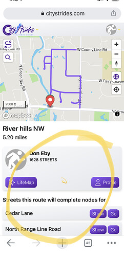
This has been a great update. has been working very well. I would love to see the ability to minimize the route information so that i can see the map full screen on my phone. I use that sometimes in combination to my current location to follow the route.
2 Likes

It looks like Map only (mostly) view could use some upvotes. I thought there was another post about an idea of a slider, allowing us to drag the map to whichever size we want - I can’t find that now.

:exploding_head: omg :rofl: I just realized that (because of the changes in Updates on November 1, 2020) I can very easily add a button to toggle between a full screen and regular-size map. lol this will be in the next release, then.
ugh, I’m really stacking up the buttons in this map :cold_sweat:

2 Likes

So is there a way to handle shortcuts across non-roads? Sometimes I find myself in a neighborhood with a lot of cul-de-sacs, and I cut through the end of them (there are sidewalks there) to the next street. It seems builder makes use of only roads, not paths. No a biggie, as I’m still going old school paper map method, but I hope to change.

edit: would be cool to drop a pin that is simply straight-line connected to next dropped pin.

Yeah, the far right button turns the auto-routing feature on/off. You’d turn it off, draw your straight-line route, then turn it back on once you’re on the road again.

1 Like

Perfect! Thank you James!

Which watch are you using? I’m intrigued by this GPX idea.

Does Route Builder produce anything that could be used on a watch?

I have the FR235, and it’s not very sophisticated when it comes to routes. I know there are some apps, but last time I looked it seemed like too many hoops had to be jumped through (need to upload to a site), so I am finding a printed map is easier.

I have a Suunto Trainer Wrist HR.

I export the gpx file created with the Route builder tool from CS to my phone and then in the Suunto app, I import the gpx file.
From the Suunto app on my phone, I transfer to my watch.

For me it’s easier to follow the track on the watch.

Marjorie

1 Like

Thank you for that @Marjorie!

1 Like