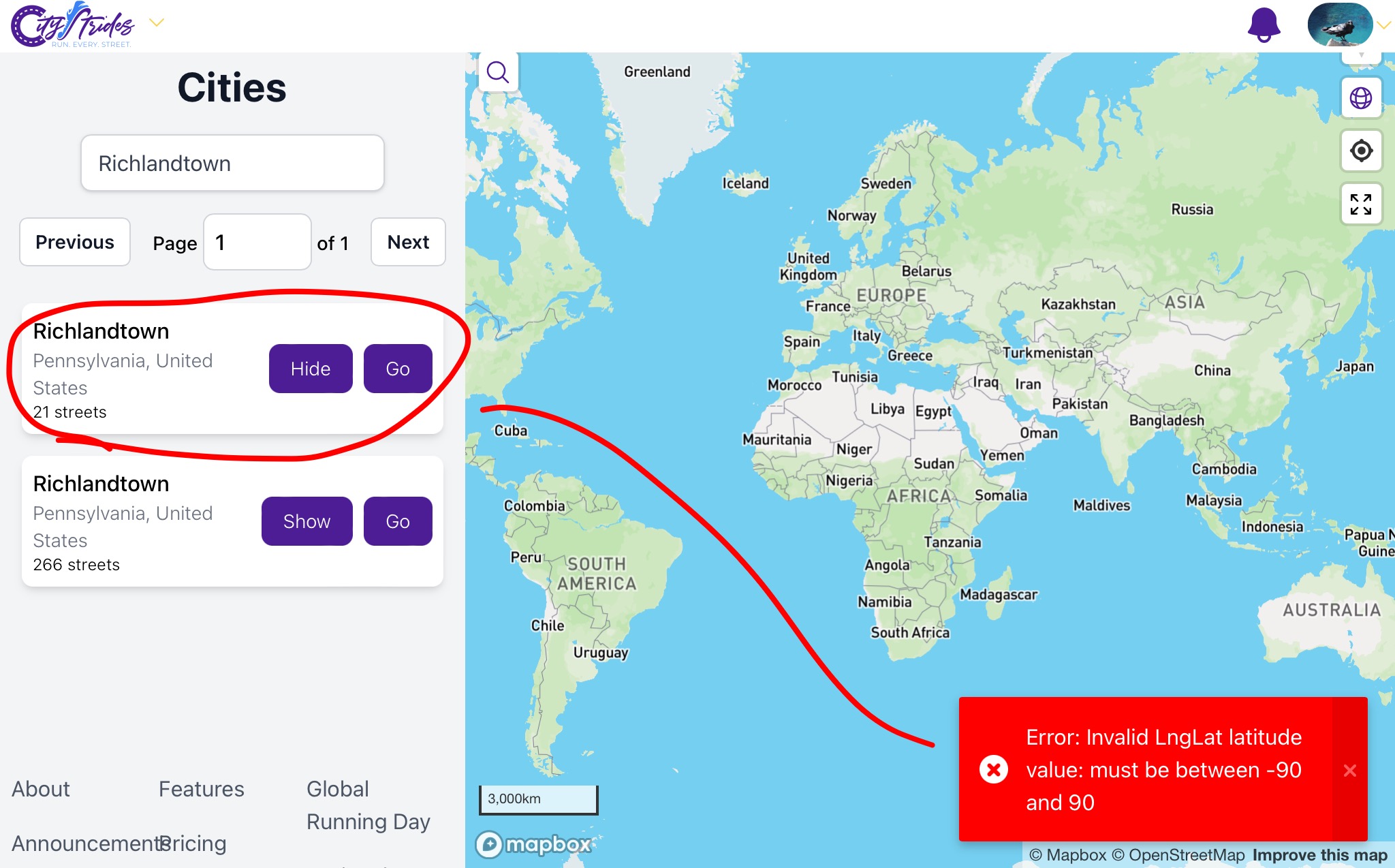
There are two Richlandtowns in eastern Pennsylvania, one being a small borough within a larger township. I can find them both in the Cities list, but cannot “Show” the smaller one because of a Lng/Lat error, as shown in the image below. How does this get fixed so I can access it in my Profile?
Another issue that has come up is that we (today) completed the 21 streets of the Borough of Richlandtown, and should have progress on the nodes in Richland Township that are adjacent, but everything currently is listed as Richlandtown (presumably the township as opposed to the boro).
I just corrected the boundary in OSM. Someone marked the outer boundary as an inner boundary, which completely broke its GeoJSON representation. After my OSM source caught up (there’s a slight delay behind the live OSM data), the border updated correctly.
I corrected the name of the other Richlandtown as well.