# Territory Expansion
**URL:** https://community.citystrides.com/t/territory-expansion/30116
**Category:** Support
**Created:** [September 7, 2026, 10:15pm UTC](https://community.citystrides.com/t/territory-expansion/30116 "2026-09-07T22:15:27Z")
**Posts on this page:** 3
**Page:** 1
### Author:  [@vgellatly](https://community.citystrides.com/u/vgellatly)
#### Post date: [September 7, 2026, 10:15pm UTC](https://community.citystrides.com/t/territory-expansion/30116/1 "2026-09-07T22:15:27Z")
### CityStrides Profile Link
> **[Victoria Gellatly - CityStrides](https://citystrides.com/users/8365)**
>
> The best tool to help you Run Every Street
### Message
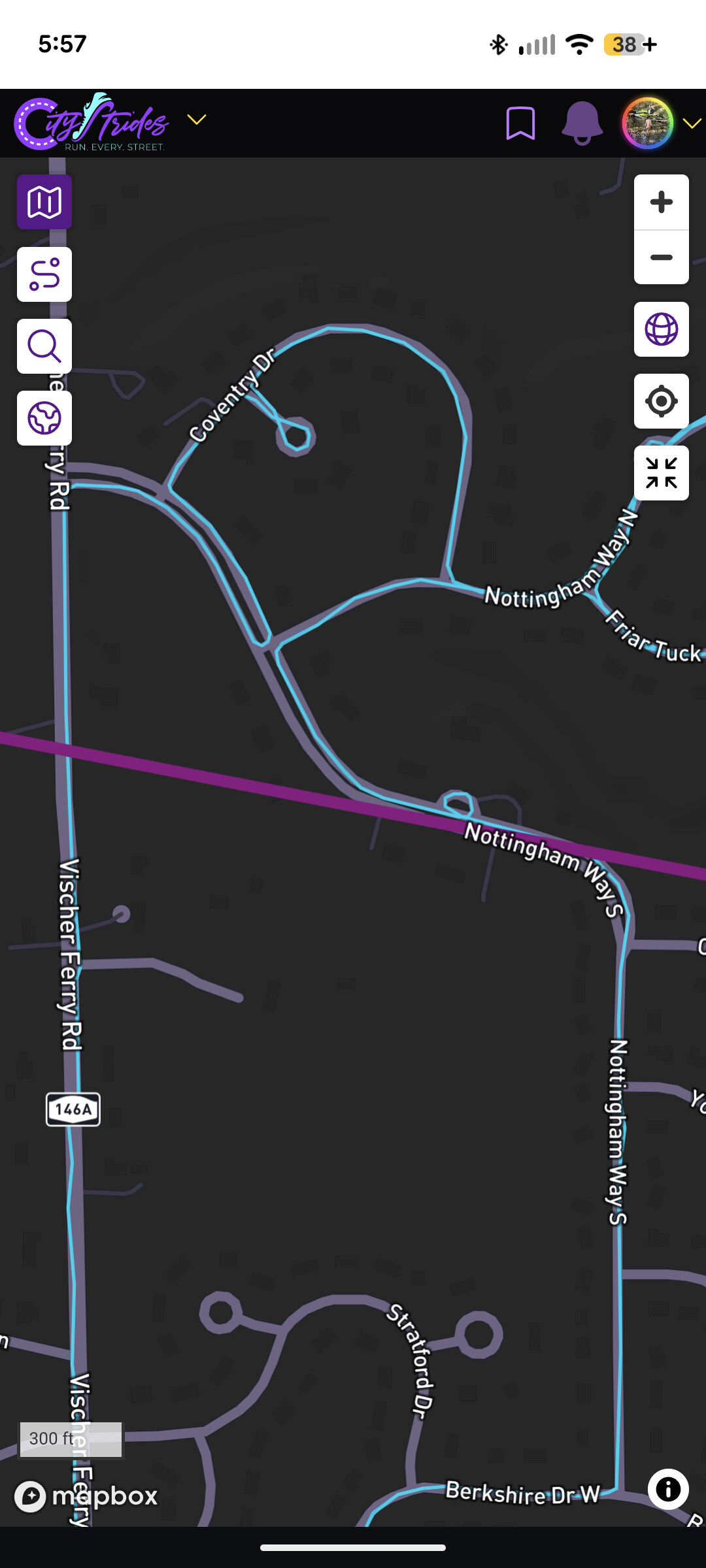
Hi all, I’m looking for some insights into the new territories function. I find it super cool and also super confusing! Specifically, I’m wondering how often they’re updated and how much overlap is required between activities for a connection to be made. The northern bound on my largest territory should be quite a bit further north from what I can tell, as the line is drawn across the middle of the road that I continued on within a single activity. It’s in the middle of a neighborhood I’ve run and walked in a couple times, and as far as I can tell, the activities overlap in a couple places. I’ve seen some gaps shared in other posts, but that doesn’t appear to be my issue. A little problem occurs at the southern bounds of my territory, but I think that may be a trail run issue, while the north is definitely on noded roads. Any information is greatly appreciated!
### Optional file upload
---
### Author:  [@tev4](https://community.citystrides.com/u/tev4)
#### Post date: [September 7, 2026, 11:23pm UTC](https://community.citystrides.com/t/territory-expansion/30116/2 "2026-09-07T23:23:46Z")
There is no minimum amount of overlap, but there is _zero_ gap tolerance.
It can take a keen eye to see the gaps sometimes. In your case, I see a frustratingly tiny gap at the intersection of Saddlebrook Rd and Lapp Rd, which will exclude everything north of there, up to Saratoga Springs, from your largest territory.
---
### Author:  [@vgellatly](https://community.citystrides.com/u/vgellatly)
#### Post date: [September 8, 2026, 12:05am UTC](https://community.citystrides.com/t/territory-expansion/30116/3 "2026-09-08T00:05:53Z")
Hi Tim, thanks for catching that. I guess I misunderstood the bounding algorithm then. Since that area was still contained within the territory I assumed it wouldn’t interfere with edges. Got it now.