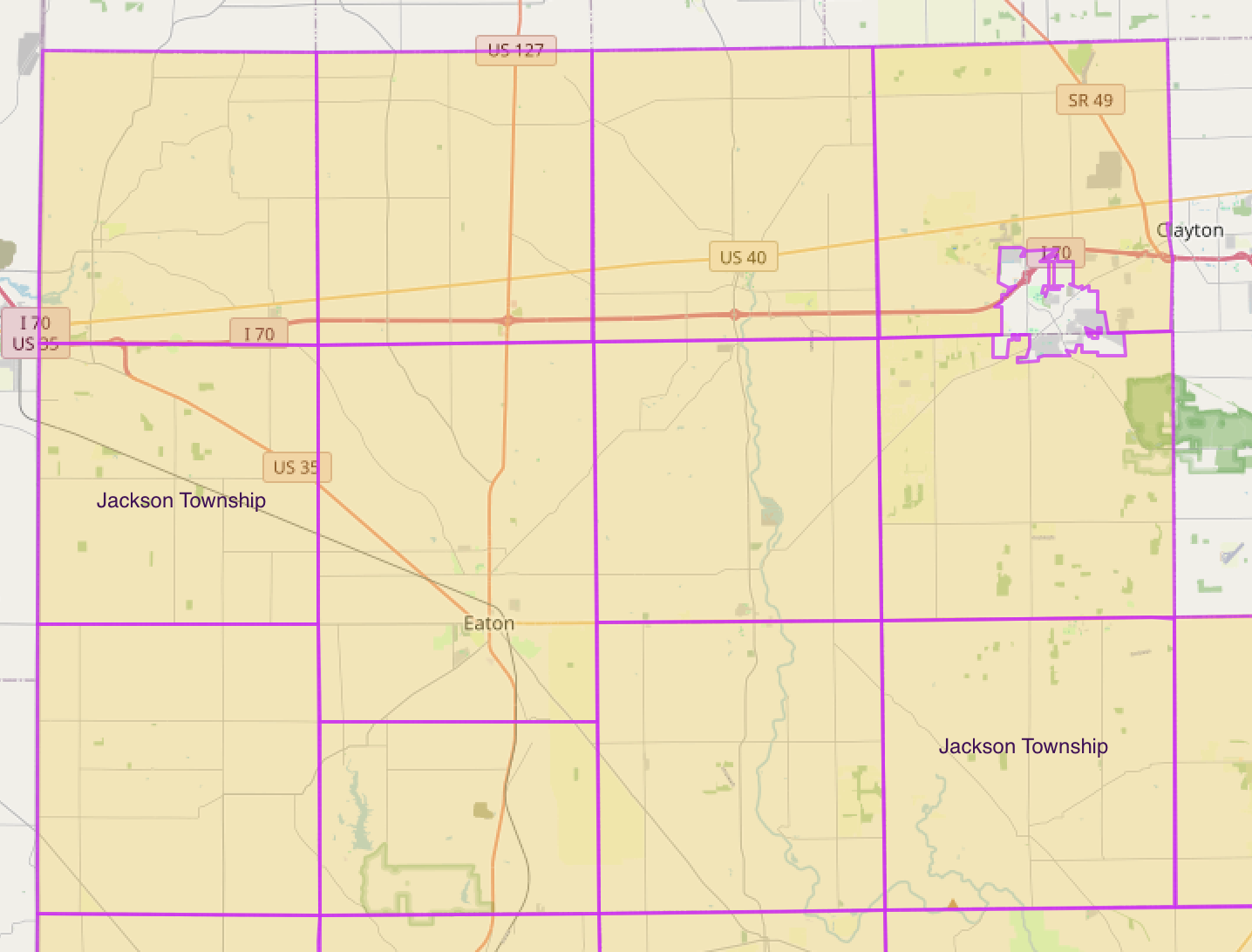
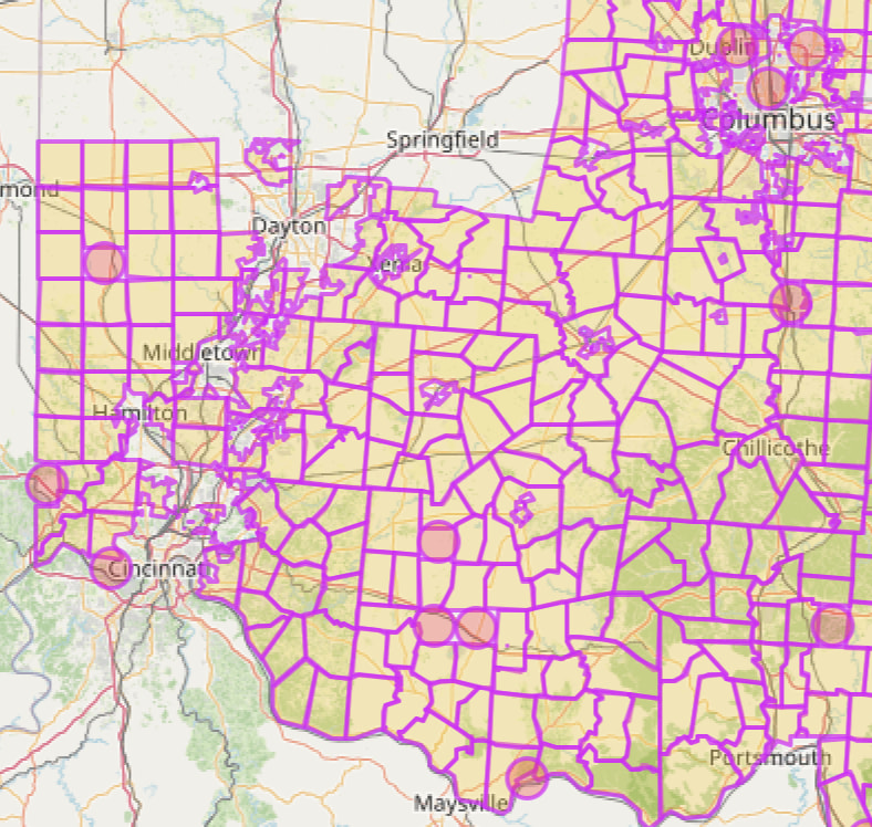
The Ohio OSM community recently completed their project of mapping all townships in Ohio. Based on their results, it looks like it would be worthwhile to replace the existing Ohio cities with their township counterparts.
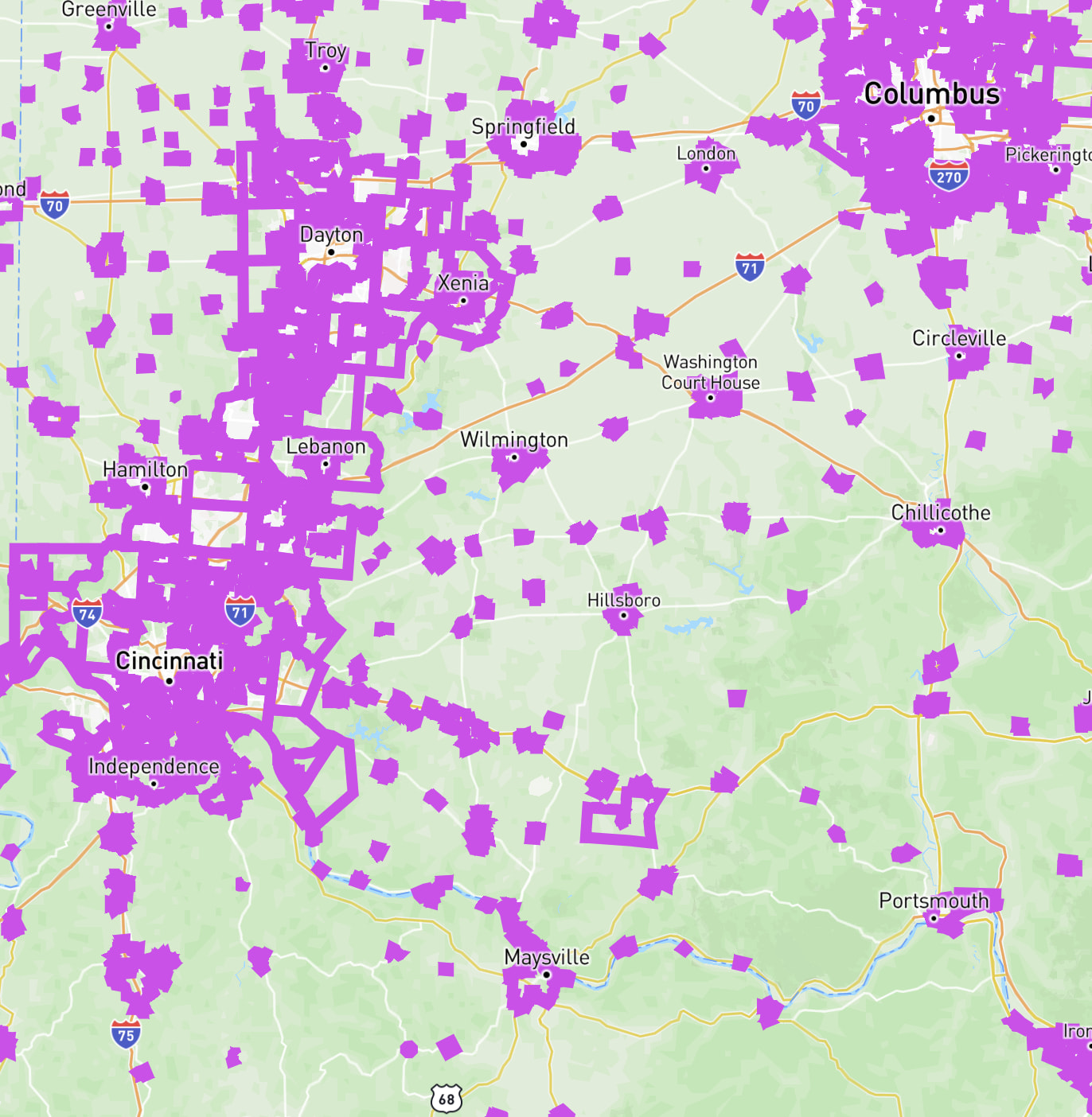
There are about 470 existing cities/villages that would be converted by this change. Dublin & Beavercreek are the two largest cities that would be converted into their townships (Washington Township & Beavercreek Township, respectively). Third, Boardman is about half the size, and only 36 of these cities/villages have more than 100 streets.
About 60 townships are already present in CityStrides.
It can be difficult to spot enclaves vs overlaps - you can click the township in a way that opens the popup unobstructively and check whether the area within it is covered or cut out
I think it’ll either stay the same or increase. Right now there are big coverage gaps, so anyone who has run in those areas will get those streets marked as progressed/completed.
My main worry is whether people in Ohio know/care about townships, especially in/around the cities in that long list.
I live in Indiana, but I’m back in Ohio somewhat frequently, If I’m lucky, I’ll have enough time to squeeze in a run or walk while I’m there. I like the addition of the townships as long as it doesn’t negatively affect the cities and villages. I don’t think any of my focus areas are affected. Hopefully, striders from Dublin and Beavercreek can provide some input.
I don’t know about all of the state, but in Southwest Ohio, I think striders will be interested in tracking cities, villages, and townships. A lot of folks identify with their particular neighborhood, and often that’s a township (Anderson, Delhi, etc.). Maybe people in other parts of the state will feel the same way.
Southwest Ohio is pretty well already on CS as far as I have seen. Myself and another strider have I’d guess 70% of Hamilton County completed. The area across the river into KY near CVG airport needs to be drawn out in OSM and added to CS but don’t think anybody knows how to do it.
@JamesChevalier , is there any way to view what percentage of a county a person has completed? Or how many miles/streets they have completed in an a county and what’s left? I’m aware that Wandrer does it, but I’ve never been much of a fan of the way the data works over there.
@steven.mcmillian fine, just forget about the SW Ohio guy with over 50% of the county…
Not sure what you mean by Ohio people know or care about townships because I would hazrard most Ohioans know the township they’re in as well as other townships nearby, at least here in the SW.
One thing you may have an issue with, Ohio loves to name townships with the same name across the whole state. Quick search, 167 townships in Ohio have the same name, 43 townships are named Washington with about a dozen that share their name with 20 other townships in the state. And because we like to keep it messy, some of those townships with the same name are only a county away.
No a bit of a first-day design decision where I was sitting at my computer with a blank text editor thinking “ok, how am I going to track myself running every street in my city” … I didn’t have a care for county, or knowledge of OSM’s structure.
It would be interesting to see all the different levels, but I’m not sure I’m up for the effort required to make that nice to interact with.
Just some poor phrasing that’s trying to get to the point of whether they’re relevant day-to-day like if you ask someone where they’re from, is it common to hear a township name back (even if they don’t say the word ‘township’)?
Oh good and it took like two seconds to find an example
For my use, I don’t see any negatives. I don’t think I’m affected by any of the 470 cities (I haven’t found one that I’ve run or walked yet), And if I ever make it to Dublin or Beavercreek for an activity, I won’t care if it’s listed as the respective township instead. I think your initial Water Cooler post caught my attention as it mentioned “it might be worth replacing existing Ohio cities with townships”. I was pretty sure you didn’t mean all cities, so I was eager to learn more details.
I could have done a better job with wording my comment. I didn’t mean that people will want to track overlapping cities/townships. I was just trying to explain that the Cincinnati suburbs are a combination of cities, villages, and townships. So I can see striders being interested in tracking the various “cities” regardless of their actual type. And I wonder if other places, like Columbus and Dayton, are like that too.
@JamesChevalier gotcha. No, we would likely not mention what township we are from. In my experience as a life long ohio resident, most of us would name the closest big city, even if it’s a decent distance away. I was suggesting, again, in my experience, most people I know from Ohio would know what township they live in, though
I am more surprised you didn’t encounter Miami Township first, There’s one in Hamilton County (where Cincinnati is) one in Montgomery County (where Dayton is) and one in Clermont County (which is the county next to the county cincinnati is in). Could make things interesting!
I live right on the edge of cincinnati, within city limits, but, right next to me is Columbia Township, Indian Hill, Mariemont, Silverton, Kenwood (which is actually mostly part of Madeira). Using just townships would make Columbia Township look like a more cohesive unit (it’s currently a mess of scattered places due to the uniqueness of it sitting between the city and all these other areas), but we would still have issues where towns would then be split up completely. Nearby Loveland comes to mind which is a town that sits in not one, nor two, but 3 different counties, which means it would also sit in at least 3 different townships (I’d have to look at that), unless Loveland has done something even stranger to ensure they’re a cohesive unit.
James, I was just busting you about Miami since I realized you were focused on SW Ohio and all 3 of those miami’s are near Cincinnati (within about an hours drive, maybe less)
This is an interesting example of how some cities stick around… Loveland would remain during this transition. Its neighbors are Symmes Township, Miami Township, and Hamilton Township.
(add #map=14/39.26959/-84.26935 to the end of the township URLs to make the boundary placements easier to see)
I honestly would have assumed Loveland would have been a mess of city (of Loveland) and townships that would be super annoying. Guess not. That’s good.
 but

 like if you ask someone where they’re from, is it common to hear a township name back (even if they don’t say the word ‘township’)?

 and it took like two seconds to find an example