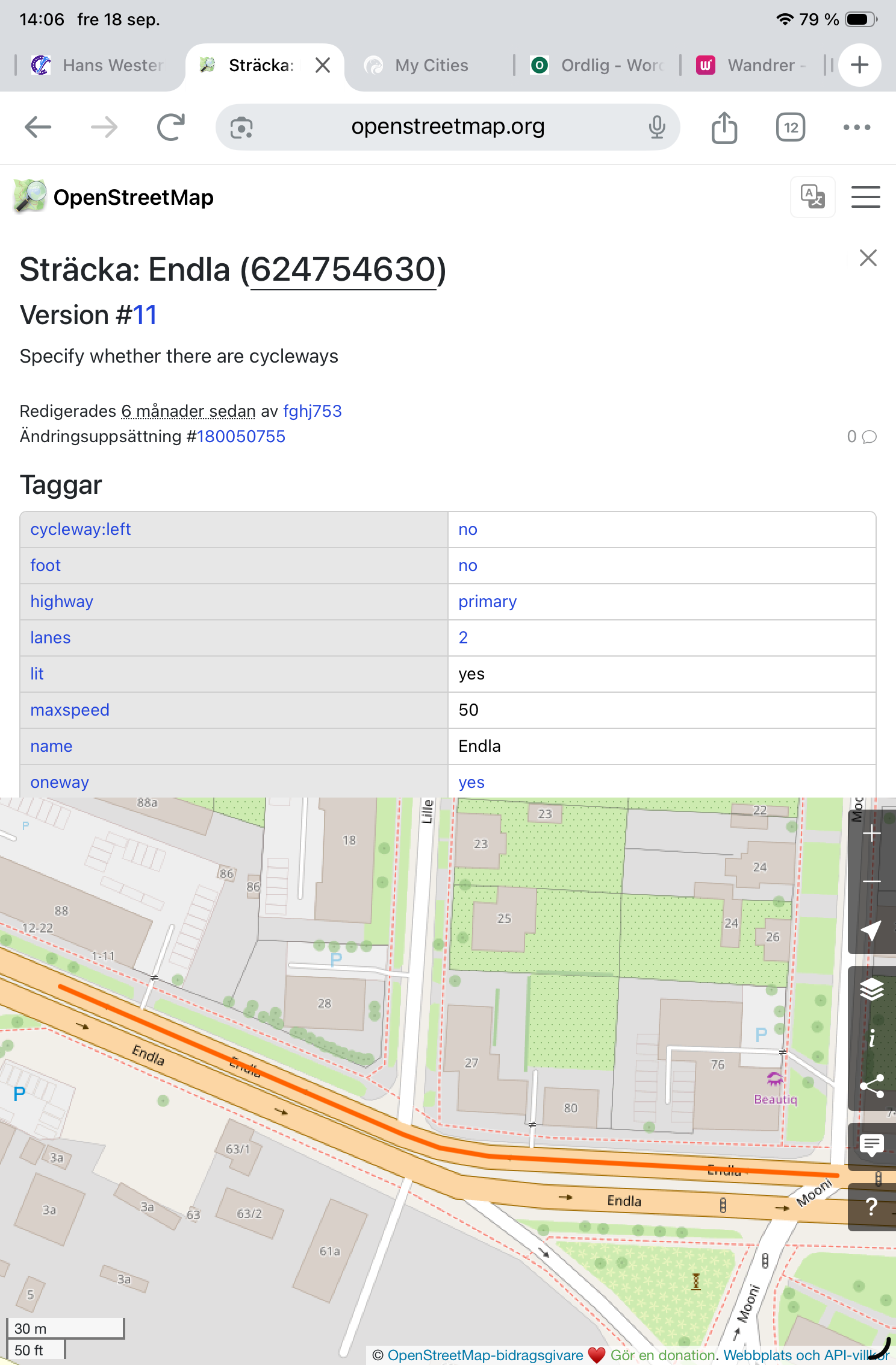
Okay, I went and learned about the OpenStreetMap editing but it looks like that the problem isn’t in the OSM but the problem is that after the last city sync CityStrides doesn’t include Primary, Secondary and Tertiary roads as streets anymore for my city.
They are completely missing from the city’s streets list in CityStrides. There were about 1620 streets in my city before the last sync, now there are 1606 and the common characteristic for missing streets seems to be that they are all either Primary, Secondary or Tertiary roads in OSM.
Sorry I don’t know yet how to get a link for a whole street in OSM. Most streets seem to be segmented into parts in OSM and I can only get a link for each small segment.
When I walked all the streets in Tallinn 2023-2025 these streets definitely were normal streets with nodes to hunt in CityStrides.
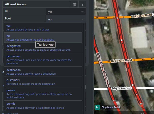
All those you list have the access tag foot=no in OSM, so they are not imported to CS. Maybe they earlier had foot=yes, and someone updated this in OSM recently
That must be it! Thank you! All these streets have normal sidewalks in reality. Maybe the OSM editor meant that one shouldn’t walk in the middle of the road between the cars and marked foot=no because of that? Well, yeah but… Oh well. I think I’m not going to go and learn how to best argue with other OSM editors.
It’s hard to follow all the discussion here, and I can’t tell who is replying to who.
The original purpose of my comment was to request a way flag streets that need to be looked at. I asked for this because I hit a lot of streets that need to be edited and since I mostly use CS for mapping, this would be a great place to just communicate that there are problems with a specific street. Being able to comment “Not a street, private driveway” or “ends at gate” would at least give information to other runners that there are problems.
I am running a lot of small towns where I’m the first person to log some of the streets. There’s huge differences between CS/Census data, google maps and what I experience in person. It would be great to communicate those things somewhere else than making a new discussion for each run or street when there are issues. I’ve mostly taken to manually completing streets because the cycle of writing notes, then editing OSM, then fighting other OSM editors to convince them that my edits are correct, then syncing, then finding my edits reverted in the next sync, is all getting to be a bit much.
The biggest issue I can see with CS is the data, and the core data is all “borrowed”. The rest of the site is pretty awesome, but this data won’t get cleaned up without user input and by allowing streets to be flagged it at least takes us a step in the right direction of helping to fix the data. I’m not asking for anyone to fix OSM, correct it in CS, or anything else drastic. This could be as simple as one form, one db table, one view edit to just offer a basic feature that allows us to communicate amongst ourselves.
@kart.seer You’re right here, that some OSM edits start to get complicated. Foot = No is probably wrong in this case, but my understanding is there’s some complexity here because you can tag streets as having sidewalks, but sidewalks can also be mapped separately … Unfortunately it has been my experience that lots of runnable streets (or sections of streets) do get excluded from CityStrides. Personally I think it’s worth trying to sort out, but only if you enjoy the process!
If you’re already making OSM edits only to find them reversed by another OSM editor, what is this table going to achieve? OSM is the source of “truth” as far as the underlying map is concerned.
Are you suggesting that James should integrate a completely separate world street map into CS? Ain’t going to happen.
Seems to me your quarrel is with a difficult OSM editor in your locality. That is unfortunate, but it’s beyond the purview of CityStrides. I would suggest to state your case based on ground truth (the edits are made based on the most important criteria for making edits in OSM - you went there, it was or was not accessible, and you edit accordingly - and if they are reverted you have a direct communication with the editor in disagreement. I’ve made hundreds of edits in OSM and had a handful of reversions for a variety of reasons, but in every circumstance the person who disagreed explained me why, and in at least a few times I was able to convince them that my edits were correct.
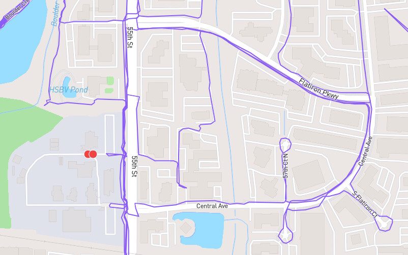
Hi Mitch, thanks kindly for your offer. I have been running streets in Boulder CO. Here is the node below. It’s practically on top of a fairly high security gate and I doubt they appreciate runners getting up close and personal to an industrial site.
are we requesting favors here? I’ll throw two into the ring:
Il-Pont ta' Manwel Dimech - CityStrides (clearly the middle node is on the highway, impossible to reach.. the spot is actually where the highway goes over a ravine, so technically i could go offroad in the bushes below but not the point)
Triq Mikiel Anton Vassalli - CityStrides (this, too, is a highway, and the only nodes that are possible to capture are where walkable roads cross, like the first one I’ve posted here)
Just closing the loop here @81cf114b4d52b9bad75e , it looks like this has been updated in OpenStreetmap (not by me). I’m not that happy with how it looks, but those streets are now marked entirely private so the nodes should go away once the city is updated in CityStrides!